GlassMountains Trip Reports

Exploring the backcountry and wilderness of the Western USA.

Trip Reports

  • SITE HOME
  • ALL
  • BICYCLING
  • CLIMBING
  • HIKING
  • SKIING
  • FAMILY

Post navigation

← Previous Post
Next Post →

Browns Peak, Arizona, December 2017

December 9, 2017 by Paul McClellan Leave a Comment

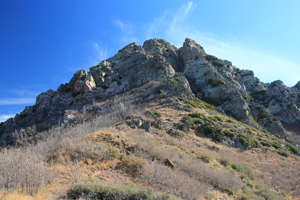
On Saturday, December 2, I joined the Southern Arizona Hiking Club (SAHC) on a climb of Browns Peak. Browns Peak is located in the Four Peaks Wilderness northeast of Phoenix at the southern terminus of the Mazatzal Mountains. It is the northernmost and highest of the Four Peaks with 7657 feet of elevation. More significantly, Browns Peak is the 18th most prominent peak in Arizona with 3297 feet of topographic prominence.

Looking up at the summit of Browns Peak. The route climbs the steep gully to the right of center.

This was my first SAHC outing for the winter season. We met early in the morning in Oro Valley, carpooled north through Globe and along Roosevelt Lake, then turned west onto the gravel El Oso Road. After several miles we eventually reached the Lone Pine Trailhead north of Browns Peak.

We started hiking on the brushy Four Peaks Trail, then joined the Browns Peak Trail nearer the peak.

Approaching the steep gully leading to the summit of Browns Peak

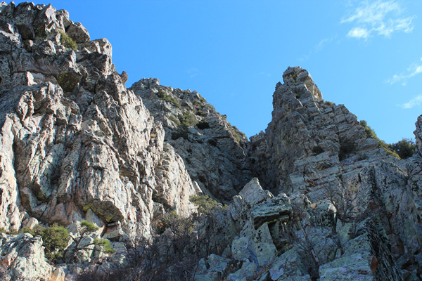
The trail becomes less defined as it leads to the base of the north face of the peak. The route leads around a corner to the base of a steep gully. The lower section of the gully was loose with talus and scree, but higher we climbed three short steep sections of firm rock with ledges and hand/foot holds. I thought it was a fun climb.

Peaks 2, 3, and 4 (right to left) of the Four Peaks

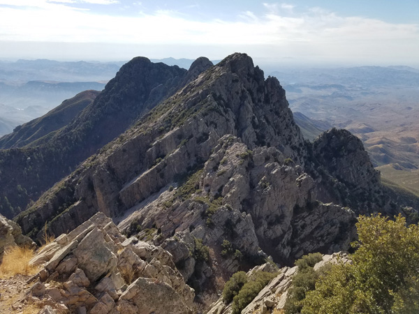
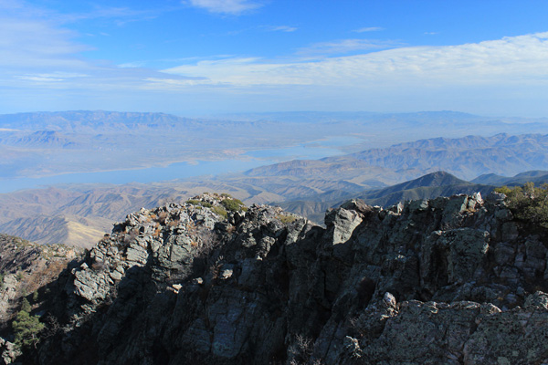
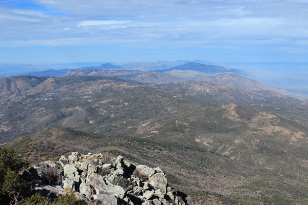
I enjoyed the views from the summit which we shared with many other climbers. The weather was ideal and the long shadows of December gave the views extra contrast.

Theodore Roosevelt Lake below. Aztec Peak is to the left and Apache Peaks are to the right in the distance.

After taking photos and having lunch we began our careful descent. The three short steep sections in the gully went well. Once back on Browns Peak Trail we followed it out to the trailhead.

Looking north along the crest of the Mazatzal Mountains

Browns Peak is a deservedly popular destination. I expect to return some day. The SAHC team, as always, was fun to climb with and I look forward to continue exploring Southern Arizona peaks with them.

Filed Under: Climbing Tagged With: Arizona, Browns Peak, Four Peaks Wilderness, Mazatzal Mountains, Southern Arizona Hiking Club

Leave a Reply Cancel reply

Your email address will not be published. Required fields are marked *

RECENT POSTS

  • Cookes Peak, New Mexico, February 2026
  • Tandem Skydiving, Oregon, August 2025
  • Castle Rock, Oregon, August 2025
  • Fish Creek Mountain, Oregon, July 2025

MONTHLY ARCHIVES

Blogroll

  • Arizona Peaks (Peavy)
  • Cycle Uphill (Sharp)
  • Desert Mountaineer (Kasian)
  • Earthline: The American West (Van Winegarden)
  • jessb.org (Beauchemin)
  • New Bohemians (Rogers)
  • Stav is Lost
  • The Mountains of Arizona (Surgent)
  • The Zenith (Baker)

Site content Copyright © 2026 Paul J. McClellan. All rights reserved.
Copyright Details
Log in