This last summer and autumn I finally hiked a few Southern Oregon Cascade Range peaks as part of my Oregon 100 Highest Peaks project. Some peaks I had known of but had neglected to visit for many years. Other peaks I had not heard of before starting on the project.
Diamond Peak
More than twenty years ago I skied from Odell Lake along the Pacific Crest National Scenic Trail (PCNST). I left the trail and skiied up to the North Summit of Diamond Peak. From that summit I could see the South (true) summit far away across the summit ridge. I planned to return someday to visit it. The years passed and other peaks distracted me from returning.
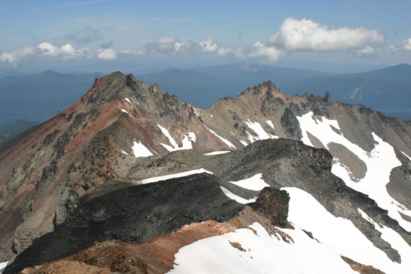
This past August I finally gave Diamond Peak an attempt. The east-side access roads (FSRs 6010 and 380) were reportedly rough. The South Ridge route required cross-country hiking and scrambling through mosquito-infested forest, then climbing talus slopes to reach the summit.
It was my first visit to the Summit Lake area and the peak’s southern slopes. It was very satisfying to finally visit the summit I had planned for so long to reach.
Pelican Butte and Mount Harriman
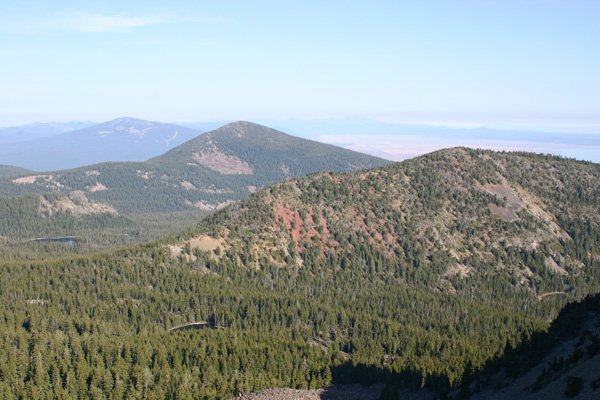
During August I also finally claimed Pelican Butte and Mount Harriman. Pelican Butte has a closed lookout on the summit. I hiked to the summit via a lookout access road (FSR 980) on the west side. It was Sunday and I met several vehicles on my hike, mostly ATVs. But I enjoyed the hike and the good views of Mount McLoughlin and Upper Klamath Lake.
Mount Harriman lies on the northern side of the Mountain Lakes Wilderness. This wilderness lies immediately east of Lake of the Woods in the Southern Oregon Cascade Range. The terrain was reportedly formed as a 12000 foot volcano that has since been eroded, leaving remnant summits and glacier-carved cirques and lakes.
I accessed Mount Harriman from the Varney Creek Trailhead. From the trailhead I followed Varney Creek Trail for a short distance. I left the trail and climbed up the north ridge. The north ridge led through forest, downed timber and brush. I scrambled up talus slopes to reach the summit.
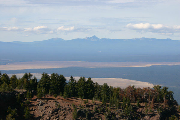
From Mount Harriman I had my first views of Aspen Butte and Mount Carmine and much of the Mountain Lakes Wilderness. As I climbed I used GPS tracking, took compass bearings, and frequently scanning the descent route to ensure I could find my way back to the trail and trailhead. These precautions helped me on my descent.
Aspen Butte and Mount Carmine
Aspen Butte and Mount Carmine lie on the southern side of the Mountain Lakes Wilderness. I returned to the Mountain Lakes Wilderness in late October to hike them. I car-camped overnight at the Clover Creek Trailhead and got an early start the next day.
From the trailhead I followed the Clover Creek Trail and the Mountain Lakes Loop Trail to access a climbers’ trail up Aspen Butte. Aspen Butte provided fine views of the Mountain Lakes Wilderness. It also provided a good view of my ascent route for Mount Carmine.
I descended back to the Mountain Lakes Loop Trail. From there I dropped down to access and scramble up the southwest ridge of Mount Carmine. The southwest ridge route was through open forest and around rock outcrops. After reaching the summit I descended to the trail and retraced my route back to the trailhead.
Yamsay Mountain
Meanwhile, in mid October, I also visited Yamsay Mountain. Yamsay Mountain is a dormant shield volcano with a glacier-carved crater viewable from the summit. The summit is the site of a former lookout tower. The trail is the former lookout access road. The road has been heavily carved with water bars (berms) for erosion control and was crossed by many downed trees.
The open forest along the trail provided alternative passages where the downed timber became too tedious to step over. I scrambled up to the summit ridge when it became visible. From the summit ridge I had views west towards the familiar Cascade Range. In other directions I recognized only a few of the many visible peaks.
My Mount Carmine climb finished the last of the Oregon 100 Highest Peaks in the Oregon Cascade Range. Thirty five years earlier I started climbing the Cascade Peaks. Now my Oregon explorations will decisively shift east towards the Elkhorn Range, the Wallowa Mountains, and the isolated peaks of Oregon’s Basin and Range country.

Leave a Reply