GlassMountains Trip Reports

Exploring the backcountry and wilderness of the Western USA.

Trip Reports

  • SITE HOME
  • ALL
  • BICYCLING
  • CLIMBING
  • HIKING
  • SKIING
  • FAMILY

Hiking Reports

Travel using primarily feet only. Hands might be used with hiking poles for balance or uphill travel.

Aztec Peak, Arizona, April 2016

April 17, 2016 by Paul McClellan Leave a Comment

On April 14 I drove from Tucson north through Globe and into the Sierra Ancha to hike Aztec Peak, the high point of the range. Aztec Peak has 7748 feet of elevation and 2468 feet of prominence, the 41st most prominent peak in Arizona. Arizona has three physiographic regions: the Colorado Plateau in the northeast, the Basin and Range in the south and west, and the Arizona Transition Zone between those two. This peak was the only peak I climbed this winter season that lies within the Transition Zone. The others I climbed lie in the Basin and Range region.
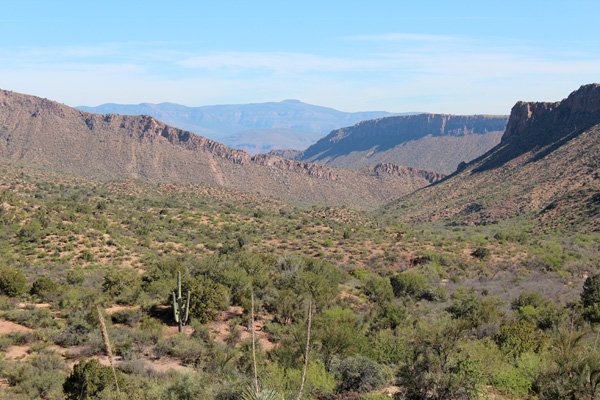
The Sierra Ancha and Aztec Peak from AZ 188 north of Globe

North of Globe I pulled off AZ Hwy 188 to photograph the Sierra Ancha and Aztec Peak. Aztec Peak is the flat summit near the center of the above photo.

[Read more…] about Aztec Peak, Arizona, April 2016
Filed Under: Hiking Tagged With: Arizona, Aztec Peak, Milk Snake, Sierra Ancha

Table Top Mountain, Arizona, December 2015

December 23, 2015 by Paul McClellan 1 Comment

Sunday, December 13, I hiked Table Top Mountain, the highest point of the Table Top Mountains west of Casa Grande, Arizona. Table Top Mountain has 2339 feet of prominence, making it the 48th most prominent peak in Arizona.

Table Top Trail is a maintained trail leading to the SW (false) summit of Table Top Mountain. From there, an unmaintained trail leads to the true summit to the northeast. I enjoyed hiking the trails and viewing the surrounding mountains and valleys in clear skies and pleasant temperatures.

Approaching the Table Top Trailhead

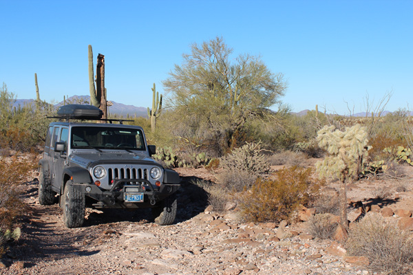
For many visitors, the challenge of visiting Table Top Mountain is the drive. The drive starts with 11.2 miles of dirt/gravel Vekol Valley Road. Then it concludes with 4.5 miles of dirt/rock access road to the Table Top Trailhead.

There were several ruts where washes crossed the roads which required high clearance. The last few miles to the trailhead was on a rocky road with narrow passages through spiny vegetation and over an occasional cholla stem. I had no issues driving these roads with my Jeep with its excellence clearance and 10-ply tires. However, I did add “Arizona pin stripes” to the sides of my Jeep.

[Read more…] about Table Top Mountain, Arizona, December 2015

Filed Under: Hiking Tagged With: Arizona, Table Top Mountain, Table Top Mountains, Vekol Valley

Mount Ballard and Fissure Peak, Mule Mountains, Arizona

November 12, 2015 by Paul McClellan 6 Comments

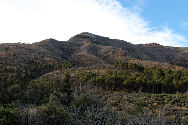
On November 10 I hiked Mount Ballard and Fissure Peak in the Mule Mountains above Bisbee, Arizona. Fissure Peak, with an elevation about 7375 feet, is considered a few feet higher than Mount Ballard. So peakbaggers credit Fissure Peak with approximately 2675 feet of prominence. This makes Fissure Peak one of the 73 Arizona peaks with at least 2000 feet of prominence, and thereby a target of people who care about such things.

Mount Ballard (on left) and Fissure Peak (just right of center) from just above Mule Pass near Bisbee, Arizona.

That morning I left the Ramsay Vista Campground high in the Carr Canyon above Sierra Vista, and drove by Bisbee north to Mule Pass. Here I found the trail leading west and upwards towards Mount Ballard. Mount Ballard and Fissure Peak to its right were soon visible from the trail. The trail crossed a fence a few times and the brush increased as I climbed.

[Read more…] about Mount Ballard and Fissure Peak, Mule Mountains, Arizona

Filed Under: Hiking Tagged With: Arizona, Fissure Peak, Mount Ballard, Mule Mountains

Carr Peak and Miller Peak, Huachuca Mountains, Arizona

November 11, 2015 by Paul McClellan 1 Comment

On November 9 I hiked Carr Peak and Miller Peak in the Huachuca Mountains above Sierra Vista, Arizona. Miller Peak at 9466 feet is the highest peak in the Huachuca Mountains and the third highest peak in Southern Arizona. Miller Peak is also an “ultra prominence” peak with 5006 feet of prominence. Carr Peak is the second highest peak in the Huachuca Mountains. Both peaks are accessible from the Carr Peak Trailhead at the Ramsay Vista Campground at the end of Carr Canyon Road.

Carr Peak from the Carr Canyon Road just below Ramsay Vista Campground

The previous late afternoon I drove from Tucson through Sierra Vista and up the Carr Canyon Road to Ramsay Vista Campground. Although I met several cars coming down the road I found the campground empty. After circling the canyon I selected site #1 for the evening. Here I set up my tent and cooked dinner by headlamp, noticing a visitor’s eyes shining in my headlamp light. I did not approach the animal, but I suspect it was a ringtail.

Before retiring to the tent I spent time scanning the starry sky. I enjoyed viewing the Milky Way and identifying constellations, and viewed the Pleiades and the Andromeda Galaxy with my binoculars. The evening was breezy as expected from the forecast.

[Read more…] about Carr Peak and Miller Peak, Huachuca Mountains, Arizona

Filed Under: Hiking Tagged With: Arizona, Carr Peak, Huachuca Mountains, Miller Peak

« Previous Page
Next Page »

RECENT POSTS

  • South Pyramid, Oregon, September 2026
  • Glacier Mountain, Oregon, July 2026
  • Baldy Mountain, Oregon, June 2026
  • Cookes Peak, New Mexico, February 2026

MONTHLY ARCHIVES

Blogroll

  • Arizona Peaks (Peavy)
  • Cycle Uphill (Sharp)
  • Desert Mountaineer (Kasian)
  • Earthline: The American West (Van Winegarden)
  • jessb.org (Beauchemin)
  • New Bohemians (Rogers)
  • OtherHand (Tom)
  • Stav is Lost
  • The Mountains of Arizona (Surgent)
  • Troy Baker's Photos

Site content Copyright © 2026 Paul J. McClellan. All rights reserved.
Copyright Details
Log in