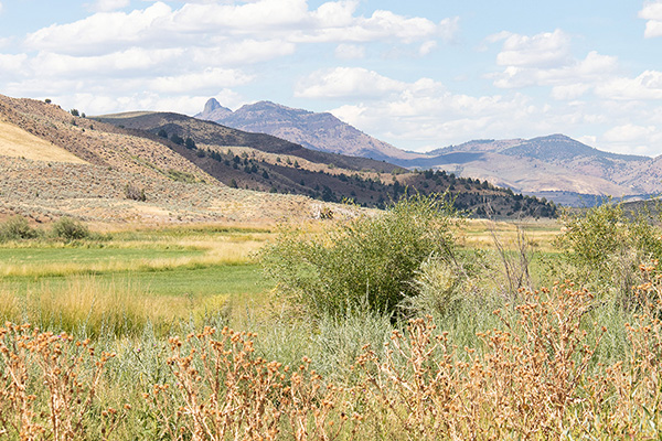
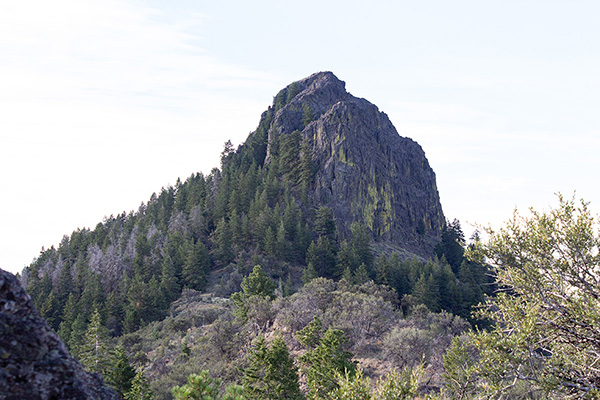
On Wednesday, August 6, I climbed Castle Rock, a steep volcanic plug north of the community of Juntura in Eastern Oregon. It seems located in a transition region between Oregon’s Blue Mountains and High Lava Plains. I have often noted Castle Rock rising above as I drove east over Drinkwater Pass between Burns and Juntura. Castle Rock is also prominent to the south from many peaks in the southern Blue Mountains. In fact, it has 1524 feet of topographic prominence and a distinctive shape.

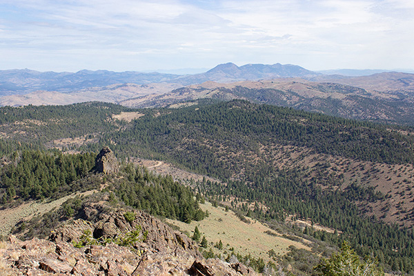
I began my adventure the day before, Tuesday, driving from the Baker Valley to Juntura. From Juntura I followed the Juntura-Riverside Road, then a more primitive road to the summit of Black Butte. This Black Butte is a prominent peak west of Juntura. From the summit of Black Butte I could see my next goal, Castle Rock, to the north.
I returned to Juntura, drove north on Beulah Road past Beulah Reservoir, and climbed north on Castle Rock Road. I turned onto a more primitive road and climbed it to the forested ridge north of Castle Rock. On the way I used a hand saw to clear some limbs of a fallen tree obstructing the road, then cut down a smaller tree leaning across the road.
There was a nice primitive campsite in a forest clearing on the ridge crest. I decided to camp there and begin my hike from camp the next morning. It was a pleasant evening and night camped there.
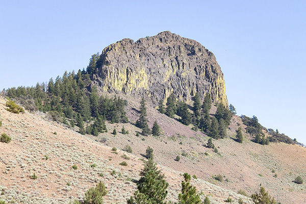
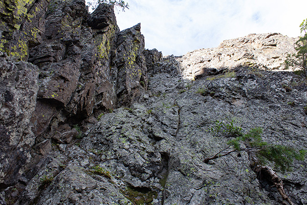
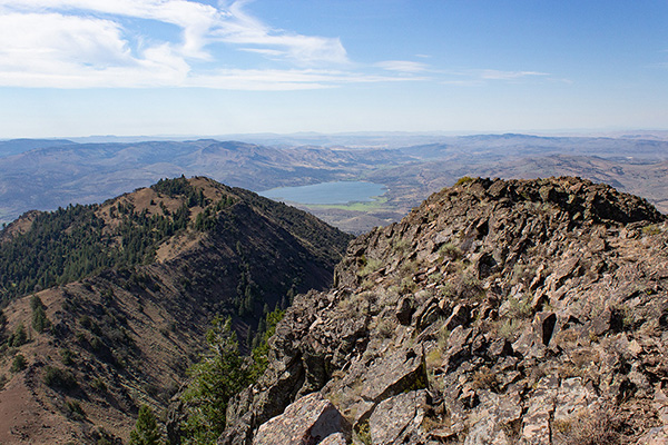
Wednesday morning I hiked south along the forested ridge crest. I generally followed a fence, sometimes on one side then the other. I passed over a rocky point and got my first view of Castle Rock that morning. Low clouds to the east cast a shadow across the upper ridge and the peak, itself.
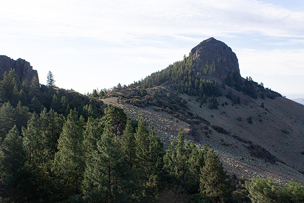
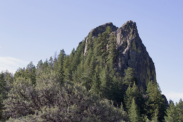
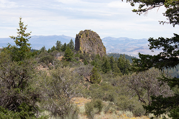
The fence led south to the north pinnacle, shorter than the main pinnacle. I passed it on the right and regained the ridge crest. Here Crater Rock rose steeply in front of me. I began to get a little apprehensive. But Caleb Morris climbed the peak in 2007 and has provided a nice trip report describing his route. So I thought if I could follow his route I should be fine.
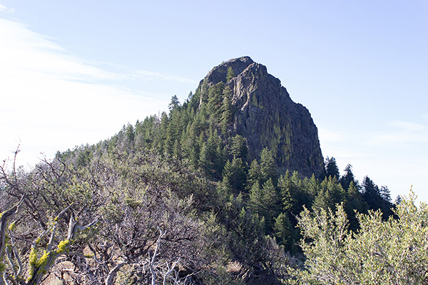
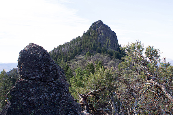
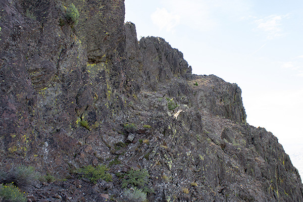
There was a nice use trail between the north and main pinnacles. The sun rose above the low clouds and gave Castle Rock more contrast. It seemed steeper the closer I approached.
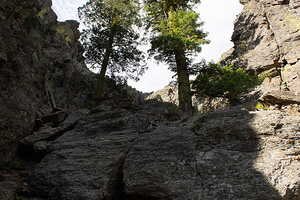
The use trail led to the gully where the climbing was to begin. The gully seemed promising. I left my hiking poles there and approached the wall at the end of the gully.
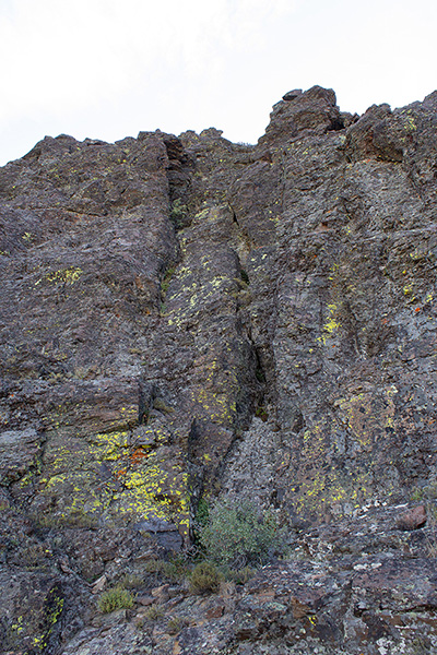
I judge climbing this wall as mostly class 3. But I thought there was a short section of class 4 where the holds were thinner and falling would cause serious injury. An old rope was lying down the face at this spot as a handhold, but it seemed unnecessary and foolish to use it. I carefully noted my route up the wall to help descending it later.
Above the wall was a memorial cross, but I did not pause to read it. I followed ledges across the west side of the pinnacle and stopped directly west below the summit point. It may be that some climbers continue further south across a loose-looking ledge system from here, but one would have to downclimb a steep step to get to it.
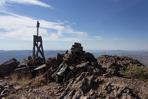
Instead, I climbed another class 4 wall directly up to the summit ridge. Again, most of this was class 3 but there was a steep point where the hand and foot holds got thin. Here I took a long step to the left. Above that the climbing eased. The top placed me a very short distance north of the well-marked summit.
Castle Rock has seen very many ascents over the decades as indicated by a large jar with a filled notepad and many pieces of paper. I found an unmarked spot in the notepad and added my name. It was only about 9:30AM, but I rested and ate a very early lunch. I enjoyed the views. Before leaving I found two USGS witness markers, but could not find the indicated benchmark. Perhaps it was buried under the summit cairn or someone had taken it as a souvenir.
Once ready, I descended the same route with care and without incident. I am a little uncertain whether to judge this route on Castle Rock a rock climb or not. It is not a trivial “scramble” with some exposure. But had I been climbing steep rock more often in recent years I expect the climb would have seemed easier and I would have felt more comfortable. Having a partner on the climb would have been reassuring as well. I took great care in planning how I would descend the walls on my ascent and this helped me find my footing. Fortunately, good and solid hand and foot holds were available.
At the bottom of the gully I retrieved my hiking poles. From there I enjoyed a pleasant forest hike back to my Jeep. I felt celebratory on my long drive back to the Baker Valley, Linda, and our dogs.

Leave a Reply