GlassMountains Trip Reports

Exploring the backcountry and wilderness of the Western USA.

Trip Reports

  • SITE HOME
  • ALL
  • BICYCLING
  • CLIMBING
  • HIKING
  • SKIING
  • FAMILY

Hiking Reports

Travel using primarily feet only. Hands might be used with hiking poles for balance or uphill travel.

Tidbits Mountain Lookout, Oregon, October 2022

October 12, 2022 by Paul McClellan Leave a Comment

On October 6, Bob F. and I visited the Tidbits Mountain Lookout site in the Willamette National Forest of Oregon. This was the first time either of us had visited the lookout site, perched atop a rock pinnacle. I was hopeful we might also visit the higher Lookout Mountain summit atop another rock pinnacle to the east of the lookout site.

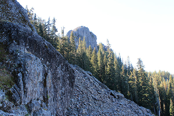
The Titbits Mountain Lookout site is on the top of the rock tower ahead

We followed forest roads from near Tombstone Pass and parked at the Gold Hill Trailhead. The Gold Hill Trail led us west through old growth forest to the Tidbits Mountain Trail. From there we continued west trail through more forest and across talus below the summit rock pinnacle. Finally we climbed up steep western slopes to reach the exposed and tiny lookout site.

[Read more…] about Tidbits Mountain Lookout, Oregon, October 2022

Filed Under: Hiking Tagged With: Cascade Range, Oregon, Tidbits Mountain, Tidbits Mountain Lookout, Willamette National Forest

Jefferson Park, Oregon, October 2022

October 5, 2022 by Paul McClellan Leave a Comment

On October 2, Bob F. and I drove to the Woodpecker Trailhead in the Willamette National Forest. From there we hiked the Woodpecker Ridge and Pacific Crest Trails to Jefferson Park, below the north face of Mount Jefferson. This was my first visit to Jefferson Park in 18 years. I wanted to visit it again and to see how the Lionshead Fire of 2020 had impacted the trails and the park, itself.

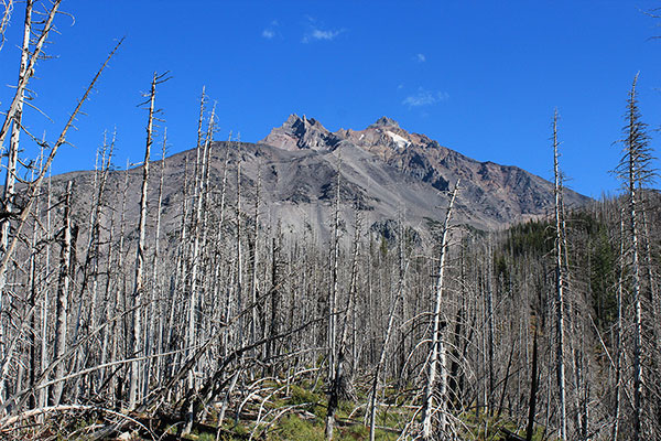
Mount Jefferson from the Woodpecker Trail and PCT junction

The Woodpecker Trailhead was still officially closed. But it was a quirk of the regulations that one could park a few hundred feet below the trailhead and hike around it to reach the trails. So we did that. Bob had a Central Cascades Wilderness Permit for the Pamelia Lake Trailhead. So we were legal and prepared for any forest rangers we might encounter.

[Read more…] about Jefferson Park, Oregon, October 2022

Filed Under: Hiking Tagged With: Cascade Range, Jefferson Park, Lionshead Fire, Oregon, Willamette National Forest

Completing My USA State Highpoints Project, March 2022

April 12, 2022 by Paul McClellan Leave a Comment

This March I completed my USA State Highpoints project by visiting Sassafras Mountain, Brasstown Bald, Cheaha Mountain, and, lastly, Britton Hill.

The Western USA State Highpoints

Paul on the summit of Mount Hood (July 1977)
Paul on the summit of Mount Hood (June 1977)

I began visiting USA State Highpoints in June 1977 with Mount Hood, the highpoint of Oregon. But I had no idea I was starting a State Highpoints project. I had previously climbed two other Oregon volcanoes and somehow the opportunity to join other work colleagues on an attempt of Mount Hood came up. This was my first experience with roped climbing on snow and ice with ice axe and crampons. I wore jeans and a cotton shirt, but the weather and conditions were excellent and I got away with my inexperience. Soon afterwards I improved my skills on a week-long snow and ice climbing course.

[Read more…] about Completing My USA State Highpoints Project, March 2022

Filed Under: Climbing, Family, Hiking Tagged With: Highpointing, Linda, USA State Highpoints

Santa Rita Peak 6280+, Arizona, January 2022

February 10, 2022 by Paul McClellan 1 Comment

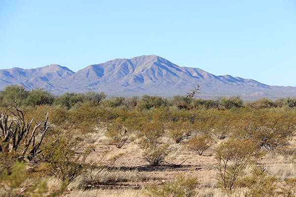
On Thursday, January 27, I visited the Santa Rita Mountains south of Tucson. Specifically I explored the northern extension of the Santa Rita Mountains that leads towards Mount Fagan. Here a ridge of little peaks has over 1000 feet of topographic prominence. However, it is not obvious from maps which peak is the highest and therefore gets the coveted prominence.

Left to right: Peak 6290, Peak 6280+, Weigles Butte, Helvetia BM, and Harts Butte from AZ Hwy 83 north of Sonoita

There seemed to be three candidate peaks. On the latest topographic map Weigles Butte has a surveyed elevation of 6284 feet. An unnamed peak about a mile south of Weigles Butte has a surveyed elevation of 6290 feet (“Santa Rita Peak 6290”). Between these two is another unnamed peak, without a surveyed elevation, but with a contour interval indicating it has at least 6280 feet (“Santa Rita Peak 6280+”). The current consensus amongst peakbaggers is that Peak 6280+ is the highest. Matthias had recently climbed this peak and thought the same. This ridge is quite visible from our bicycling routes on the east side of Tucson. So I decided to visit these peaks to decide for myself.

[Read more…] about Santa Rita Peak 6280+, Arizona, January 2022

Filed Under: Hiking Tagged With: Arizona, Santa Rita Mountains, Santa Rita Peak 6280+, Santa Rita Peak 6290, Weigles Butte

« Previous Page
Next Page »

RECENT POSTS

  • Cookes Peak, New Mexico, February 2026
  • Tandem Skydiving, Oregon, August 2025
  • Castle Rock, Oregon, August 2025
  • Fish Creek Mountain, Oregon, July 2025

MONTHLY ARCHIVES

Blogroll

  • Arizona Peaks (Peavy)
  • Cycle Uphill (Sharp)
  • Desert Mountaineer (Kasian)
  • Earthline: The American West (Van Winegarden)
  • jessb.org (Beauchemin)
  • New Bohemians (Rogers)
  • Stav is Lost
  • The Mountains of Arizona (Surgent)
  • The Zenith (Baker)

Site content Copyright © 2026 Paul J. McClellan. All rights reserved.
Copyright Details
Log in