Sunday, December 13, I hiked Table Top Mountain, the highest point of the Table Top Mountains west of Casa Grande, Arizona. Table Top Mountain has 2339 feet of prominence, making it the 48th most prominent peak in Arizona.
Table Top Trail is a maintained trail leading to the SW (false) summit of Table Top Mountain. From there, an unmaintained trail leads to the true summit to the northeast. I enjoyed hiking the trails and viewing the surrounding mountains and valleys in clear skies and pleasant temperatures.
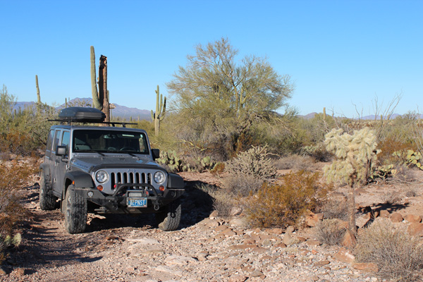
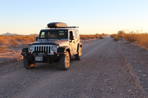
For many visitors, the challenge of visiting Table Top Mountain is the drive. The drive starts with 11.2 miles of dirt/gravel Vekol Valley Road. Then it concludes with 4.5 miles of dirt/rock access road to the Table Top Trailhead.
There were several ruts where washes crossed the roads which required high clearance. The last few miles to the trailhead was on a rocky road with narrow passages through spiny vegetation and over an occasional cholla stem. I had no issues driving these roads with my Jeep with its excellence clearance and 10-ply tires. However, I did add “Arizona pin stripes” to the sides of my Jeep.
I parked in one of the three campsites at the Table Top Trailhead. I saw one ATV nearby but had only seen one other vehicle on the drive in. Table Top Mountain is visible from the trailhead, often framed behind saguaro and ocotillo.
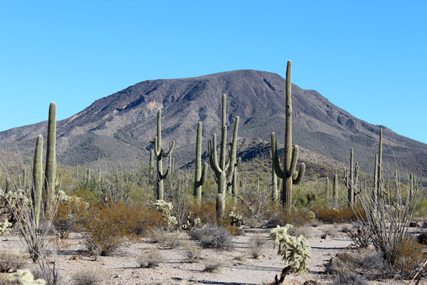
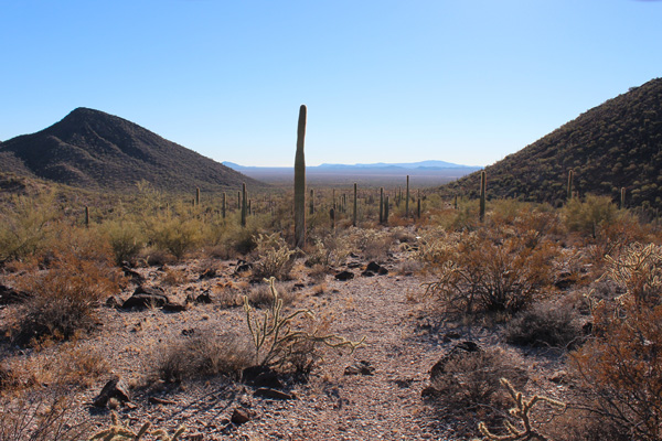
The Table Top Trail leads directly towards Table Top Mountain. It crosses a few washes. Then it switchbacks up a ridge to the SW summit. The ridge is just left of center and the SW summit is just out of view in the above photo. There were many species of Sonoran Desert plants along the trail.
The trail is rocky as it switchbacks steeply up the ridge. Eventually the trail ends at the SW summit with excellent views especially to the south and west.
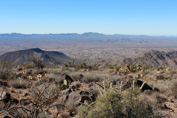
The true summit is to the northwest from here with a significant bowl between the two. From the SW summit, an unmaintained trail leads to near the summit by traversing around the bowl counterclockwise. As I hiked this trail I enjoyed excellent views of many mountains ranges and valleys to the south.
I left the trail to reach the highest point. There I found a pile of rocks supporting a metal pole. There was a cleared area in the pile exposing the benchmark and a plastic jar contained the summit register.
The views to the east were best from this point. The gradual slope of the summit did not provide such good views to the north. But I did savor the view of the Sierra Estrella to the north where I had climbed the previous day.
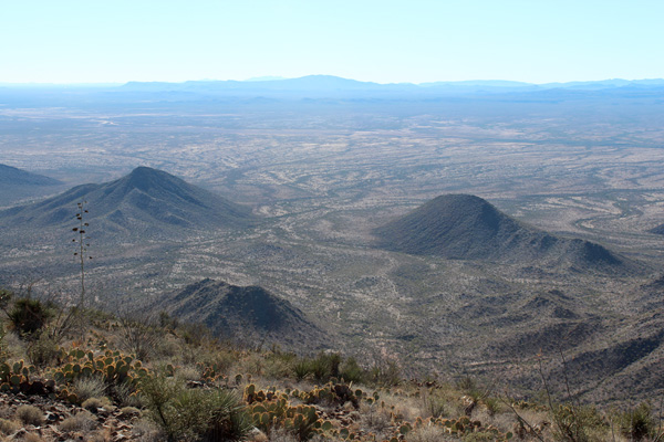
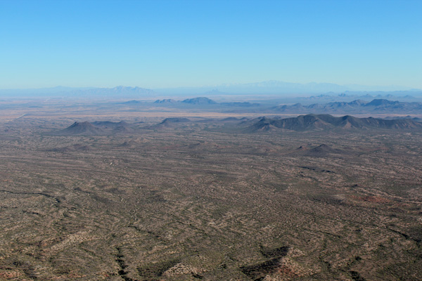
I returned the same route to the SW summit, then started the descent towards the trailhead. The photo above shows the view towards the Vekol Valley and the Table Top Trailhead from high on the trail. The trailhead is just right of the right-hand ridge leading down the small peak left of center in this photo.
The afternoon sun was getting low in the sky as I approached the trailhead, adding color to the scenery. I relaxed back at the campsite a few minutes before leaving. The campsite seemed an inviting place to spend the evening and night with dark skies and solitude. But I needed to start for home and wetter weather was forecast for the next day.
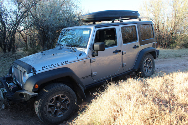
On the morning drive in I had sometimes held my breath as I rolled through deep ruts cut in the roads. After that experience I felt more relaxed on the drive out, stopping to take photos at some of them. Indeed, I was pleased with my jeep’s good approach, breakover, and departure angles. These past two days had been good Jeep driving experiences.
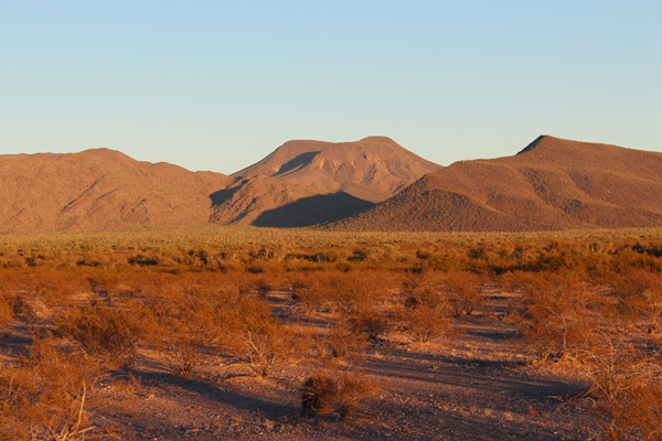
I finally neared Interstate 8 on Vekol Valley Road in the afternoon and stopped for some last photos. The low sunlight provided a colorful view of Table Top Mountain. In this photo the SW summit is on the right and the true summit is on the left.
The small campground at the Table Top Trailhead seemed an inviting place to spend a night with clear skies and solitude. However, after returning home I googled “Vekol Valley” and learned of its recent history of illegal immigration, drug smuggling, and murder.

I’ve been looking for some to share their firsthand experiences with climbing Tabletop Mnt. I was planning to hike it this coming December with my son, thanks for the good gouge!