Linda and I spent several weeks in March of 2014 visiting Arizona for bicycling and hiking. This was our third Spring visiting Arizona and we were curious to see locations we had not previously visited. I enjoyed hiking several Arizona “prominence peaks”: Mount Ord, Pinal Peak, Mount Graham, and Chiricahua Peak. The only significant snow I encountered was on Mount Graham, and it was manageable. The weather was ideal for hiking and enjoying the scenery.
On March 10 we camped near the city of Sedona. The next day we moved camp to Dead Horse Ranch State Park near Cottonwood. We explored around Cottonwood on our bikes. On on March 13 we relocated to Payson Campground and RV Resort which was our base for four days.
On March 14 we drove south from Payson on AZ Hwy 87, turned east off the highway, and followed a gravel road to a locked gate. From the gate we hiked to the summit of Mount Ord, a 2000 foot prominence peak in the Mazatzal Mountains. The weather on the summit was light and intermittent hail turning to drizzle with thunder in the distance. But the hike was pleasant with good views of the mountains and valleys south of Payson. After returning to the highway we visited Fountain Hills, near Mesa.
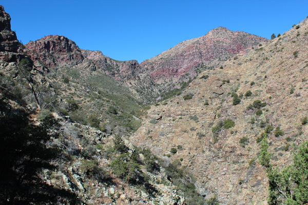
On March 15 I hiked on the Barnhart Trail in the Mazatzal Wilderness near Payson. This was an exploratory hike. I thought I might be able to summit Mazatzal Peak, the highest peak in the Mazatzal Mountains.
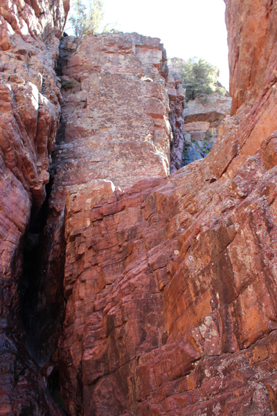
The Barnhart Trail soon entered Barnhart Canyon, then switchbacked up left. I followed the trail as it climbed up a side canyon. The trail led past cliffs and a waterfall and pool as it climbed towards the higher slopes of Mazatzal Peak. Big Kahuna Falls are formed by a seasonal creek on the north slope of Mazatzal Peak above Barnhart Canyon. It is a popular hiking destination.
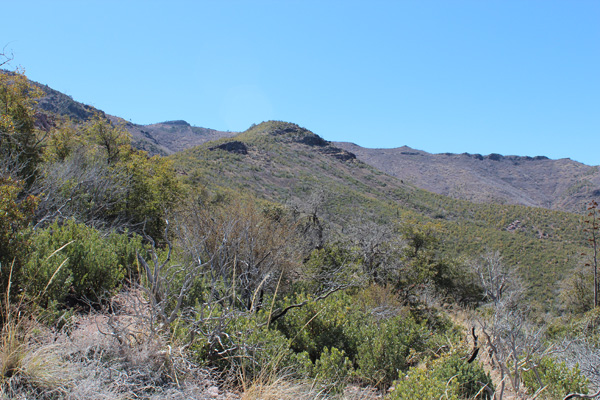
The trail climbs onto the NW Ridge of Mazatzal Peak and meets a trail junction at about 6000 feet. A recent wildfire apparently destroyed a forest here. The slopes are now very brushy. The crux of any summit attempt from here would be to minimize the brush thrashing while traversing upwards towards the summit. But I was not prepared for this. Next time I will be.
The next day, March 16, we bicycled through Payson to get to know it better. Perhaps we would return to Payson on another Arizona trip.
On March 17 we broke camp and headed south to set up camp at Usery Mountain Regional Park. Linda had been fortunate to reserve a site for us a few days earlier – someone had cancelled their reservation. We explored nearby Mesa that afternoon.
We mountain biked in the park the next day, and experienced some flat tires. Most likely the flats were caused from cholla fragments lying on the trail. I can appreciate why many mountain bikers use tubeless tires to deal with this desert biking issue. Our friend Mary from Bend arrived that afternoon. We relaxed in camp enjoying the roomy site, its many native plants and birds, and a pleasant sunset.
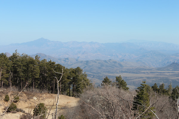
On March 19 we drove over the Apache Trail (AZ Hwy 88) to Roosevelt Lake. We continued through Globe, then up a road towards Pinal Peak. Pinal Peak is the highpoint of the Pinal Mountains with over 4000 feet of prominence. We parked the car a few miles short of the summit, then walked the road past several summer homes to the summit and back.
We spent March 20 bicycling from Usery Park to Mesa, through Apache Junction towards the Superstition Mountains. The riding was easy and the views of the Superstitions were interesting – a hiking destination someday. We returned to camp the same route.
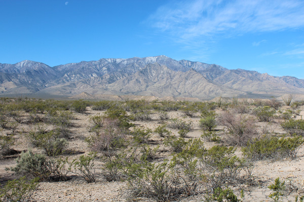
On March 21 we broke camp at Usery Park and relocated to Roper Lake State Park near Safford. That afternoon I drove up the Swift Trail Parkway to a locked gate and parking area at 9158 feet elevation. Here I planned to start my hike up Mount Graham the next morning.
The road up was paved and steep with sharp turns. I wondered if Linda might like to descend the route tomorrow on her bike while I hiked. She would have to descend carefully if so.
On March 22 I returned to hike Mount Graham, the highest point in the Pinaleno Mountains. Mount Graham is the most prominent Arizona peak with 6320 feet of prominence. Linda rode up with me and enjoyed a sometimes challenging 6000-foot bike descent back to Roper Lake State Park.
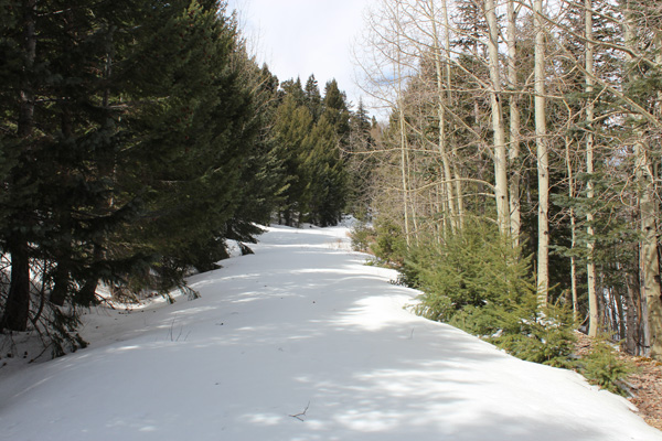
From the parking lot I followed Forest Road 507 most of the way to the summit of Mount Graham. This road was mostly clear of snow, but did have a few covered sections. I skirted around or broke through while crossing those sections.
I left the road just short of the summit and hiked higher through downed burned timber. Eventually I found the summit registry and benchmark at 10720 feet. The registry was in a burned out stump under downed timber. Near the summit I noticed an observatory building on an adjacent rise to the west.
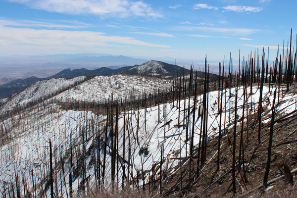
The best views through the burned timber were to the east and south. To the east I looked down 7600 feet towards Roper Lake State Park. To the south past Heliograph Peak I observed Dos Cabezas Peaks and the Chiricahua Mountains. In the photo above Heliograph Peak is in the center. To the left of it Dos Cabezas Peaks lie in the mid distance. The Chiricahua Mountains lie farther on the horizon.
On March 23 I drove south from Roper Lake State Park through Willcox towards the Chiricahua Mountains. I drove up into the forested mountains to trailhead parking at the Rustler Park Campground. The campground was closed due to the Horseshoe 2 Fire of 2010; work was underway to remove the burnt trees.
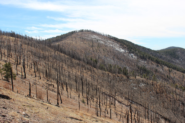
My plan was to hike Chiricahua Peak, the highest point in the Chiricahua Mountains. I followed the Chiricahua Crest Trail (#270) from the campground to where it forked just below Chiricahua Peak. From there I climbed the Chiricahua Trail to the forested summit.
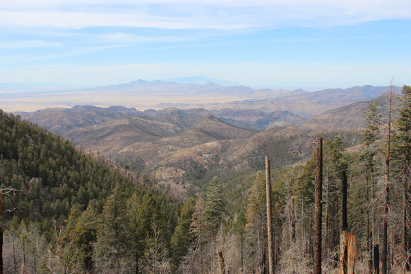
It was a mostly clear day with great views to the north. I encountered a little ice on the trail below the cliffs near the start and a few snow patches elsewhere. But the trail was virtually snow-free. Unfortunately much of the forest along the trail had been burned. I returned to my Jeep and drove back to our campsite at Roper Lake.
The next morning, March 24, we broke camp and headed north towards home. We camped at Page Arizona, Wells Nevada, and Eagle Idaho on the way. It had been a memorable trip.

Leave a Reply