GlassMountains Trip Reports

Exploring the backcountry and wilderness of the Western USA.

Trip Reports

  • SITE HOME
  • ALL
  • BICYCLING
  • CLIMBING
  • HIKING
  • SKIING
  • FAMILY

Hiking Reports

Travel using primarily feet only. Hands might be used with hiking poles for balance or uphill travel.

Crossman Peak, Arizona, January 2021

January 29, 2021 by Paul McClellan Leave a Comment

On Friday, January 22, I drove east through Lake Havasu City on residential roads to find access to Crossman Peak. Crossman Peak, the highpoint of the Mohave Mountains, is the 24th most prominent peak in Arizona with 3120 feet of topographic prominence. It also has 21.7 miles of isolation. Such a peak should provide great views, but I could see very little from the summit this day. Crossman Peak was clouded in and the weather forecast called for afternoon thunderstorms.

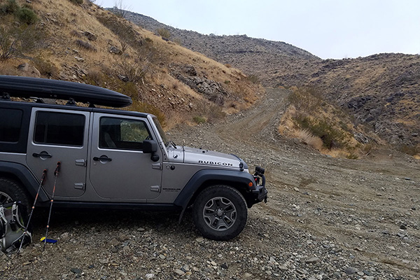
My Jeep parked below the steep climb around the ridge leading to a locked gate

The paved residential roads suddenly ended and the road became coarse gravel and rock. It led through a popular 4-wheeling area and then up the Falls Springs Wash towards Crossman Peak. I was glad for my Jeep’s high clearance and sturdy tires and was able to drive to a broad parking area at a steep turn. Beyond here the road reportedly climbed steeply around a ridge to a locked gate. It was the ideal spot to park.

[Read more…] about Crossman Peak, Arizona, January 2021

Filed Under: Hiking Tagged With: Arizona, Crossman Peak, Mohave Mountains

Mohon Peak, Arizona, January 2021

January 27, 2021 by Paul McClellan 1 Comment

On Wednesday, January 20, I joined Michael Berry on a climb of Mohon Peak, a remote peak about 75 miles ESE of Kingman, Arizona. Mohon Peak, the highpoint of the Mohon Mountains, is the 64th most prominent peak in Arizona with 2059 feet of topographic prominence. Mohon Peak also has 34.1 miles of isolation, the distance to the nearest higher peak. The area is checkerboarded with private and public land, appearing to be used exclusively for cattle ranching.

Our first view of Mohon Peak from Bogles Ranch Road and the Aquarius Mountains

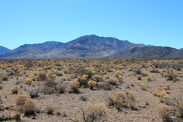
Michael and I met Wednesday morning in the community of Wikieup, between Wickenburg and Kingman on US Hwy 93. It had rained hard the previous day and the skies were cloudy this morning. The weather report hopefully suggested the weather would improve by afternoon. We drove our two vehicles north on US 93, then turned east and drove on dirt and gravel roads over the Aquarius Mountains. We descended into an open valley of mesas and canyons. At mile 14 we finally saw Mohon Peak for the first time with fresh snow and rain showers in progress. At least we would learn the driving route if we had to abandon the climb.

[Read more…] about Mohon Peak, Arizona, January 2021

Filed Under: Hiking Tagged With: Arizona, Mohon Mountains, Mohon Peak

Greasewood Mountain, Arizona, January 2021

January 12, 2021 by Paul McClellan 2 Comments

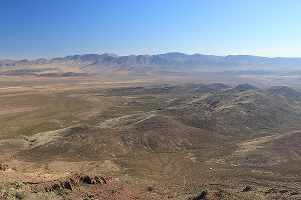
On Tuesday, January 5, I climbed Greasewood Mountain and Grease Benchmark in the southern Pinaleno Mountains just north of Willcox, Arizona. Greasewood Mountain is the 101st most prominent peak in Arizona with 1751 feet of prominence. Grease Benchmark is the subsidiary southwestern summit of this double-summited peak. I had driving waypoints from the Southern Arizona Hiking Club and the relevant topographic maps.

A morning view of Greasewood Mountain from the drive in from Willcox.

I left Tucson early in the morning and drove east on I-10 to Willcox. Taking the Fort Grant exit I headed north towards the peak. The road soon turned to gravel but was in good condition. The route took a gas line road, a powerline road, and finally entered Wood Canyon where the road deteriorated.

[Read more…] about Greasewood Mountain, Arizona, January 2021

Filed Under: Hiking Tagged With: Arizona, Grease Benchmark, Greasewood Mountain, Pinaleno Mountains

Mount Hopkins, Arizona, December 2020

December 17, 2020 by Paul McClellan 2 Comments

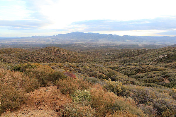
On Thursday, December 3, I hiked to the summit of Mount Hopkins in the Santa Rita Mountains of Southern Arizona. The Santa Rita mountains form the southern border of the Tucson basin. The highest peak of the range, Mount Wrightson, rises about 7000 feet above Tucson. It is accompanied to its west by lower Mount Hopkins. Both peaks are quite visible from bicycle routes in Tucson. I had hiked Mount Wrightson in March 2015, but had not yet visited Mount Hopkins. So it was past time to do so.

Mount Hopkins from the Super Trail (2015-03-10)
Mount Wrightson from the Agua Caliente Trail

I drove to Madera Canyon and parked at the end of the road with access to several trails. I followed the Old Baldy, Vault Mine, and Agua Caliente Trails to a saddle below Mount Hopkins on its east side. It was quite windy and cool in the morning, but I was sheltered from most of the wind while climbing up the steep north side of the peak.

[Read more…] about Mount Hopkins, Arizona, December 2020

Filed Under: Hiking Tagged With: Arizona, Fred Lawrence Whipple Observatory, Mount Hopkins, Santa Rita Mountains

« Previous Page
Next Page »

RECENT POSTS

  • Cookes Peak, New Mexico, February 2026
  • Tandem Skydiving, Oregon, August 2025
  • Castle Rock, Oregon, August 2025
  • Fish Creek Mountain, Oregon, July 2025

MONTHLY ARCHIVES

Blogroll

  • Arizona Peaks (Peavy)
  • Cycle Uphill (Sharp)
  • Desert Mountaineer (Kasian)
  • Earthline: The American West (Van Winegarden)
  • jessb.org (Beauchemin)
  • New Bohemians (Rogers)
  • Stav is Lost
  • The Mountains of Arizona (Surgent)
  • The Zenith (Baker)

Site content Copyright © 2026 Paul J. McClellan. All rights reserved.
Copyright Details
Log in