On September 2 I climbed Mount Peale in the La Sal Mountains east of Moab, Utah. Mount Peale is an “ultra prominence peak” with 6161 feet of prominence. With 12721 feet of elevation it is the highest point of the La Sal Mountains.
In early September I was driving to Durango, Colorado, through Utah to meet up with some friends there. We planned to hike into the Chicago Basin and summit a few Colorado Fourteeners together. But the weather forecasts kept deteriorating and we eventually decided to go our own ways.
At that point I was in Spanish Fork, Utah. I had maps and route information for several Utah prominence peaks with me and a week to work with. I had driven through Utah many times. But the only Utah peak I had previously visited was Kings Peak in the High Uinta Mountains. So I eagerly decided to spend the week hiking several Utah prominence peaks. In this way I could sample several Utah mountain ranges I had not yet visited.
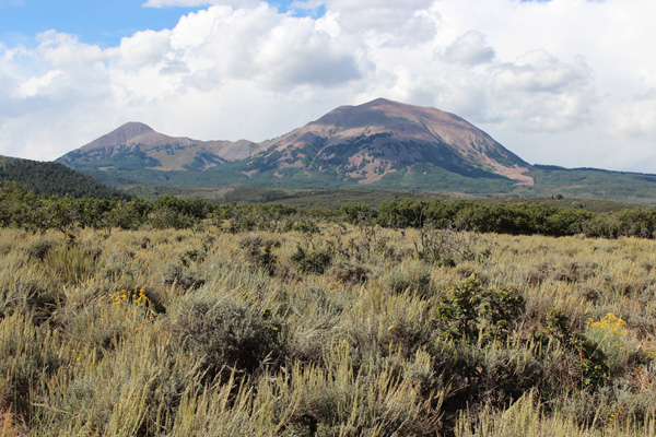
The La Sal range is quite visible from Arches National Park. I had noticed the range to the southeast when I first visited the Park in September 1982. Since then I have always noted the range from I-70 on several visits to Colorado. I was eager to climb Mount Peale, one of the 57 “Ultra Prominence” peaks of the 48 Contiguous US States.
On the afternoon of September 1 I drove to La Sal Pass and the Burlfriends Trailhead at 10125 feet elevation. I camped near the trailhead. From camp I identified the south-facing gully I would use to reach the summit ridge of Mount Peale. I had a pleasant night there.

The next morning, September 2, I started hiking the Burlfriends Trail. I followed the trail to a junction with the Tuk Trail. Here a sign indicated the ridgeline was 1.5 miles ahead on it. I followed the Tuk Trail a short distance until I decided it was headed too far west.
Instead, I traversed across a meadow to intersect a jeep trail. Further I followed a climbers’ trail leading up into the south-facing gully I had seen from camp. The gully narrowed and laid back a bit as I climbed upward onto talus.
Eventually the trail became less distinct. I followed occasional boot tracks up the talus slopes to my right and reached the summit ridge west of the summit. Here I regained the climbers’ trail and followed it to the summit.
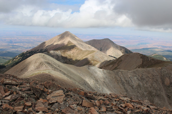
It was a partly cloudy morning and the clouds cast shadows adding depth to the views. Mount Tukuhnikivatz (“Tuk”) rose to the west along a long ridge. Mount Tuk is more visible than Mount Peale from the west. I think years earlier I mistook Mount Tuk for Mount Peale. Now I know the difference. In the above view Moab lies at the head of the green valley visible to the right of Mount Tuk.
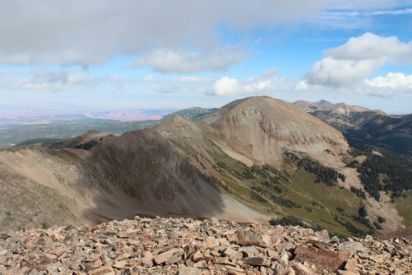
To the north Mount Mellenthin was decorated with cloud shadows. The Colorado River was visible just left of it in the distance. Mount Waas rose in the distance to the right. I searched repeatedly around and within the talus walls enclosing the summit looking for a benchmark or summit registry. But I found only a quite small USGS marker bolted to a rock.
I descended down the gully. Lower, I followed the jeep trail and the Burlfriends trail back to the trailhead at La Sal Pass. It was a popular day for ATVers traveling across the pass from the west. I also saw a few mountain bikers on the trail. I loaded up and headed for my next goal, Abajo Peak near Monticello, Utah.

Leave a Reply