The summer had ended and autumn had begun without my returning this year to hike peaks in Southeast Oregon. There was only one more peak on my Oregon’s Highest Peaks list in SE Oregon I had not yet climbed. I had that peak in mind when I traded my Ford Explorer in for a Jeep Rubicon. On Thursday, October 24, I packed my jeep and began my explorations of Southeast Oregon Peaks.
Oregon Canyon Mountains Highpoint
The Oregon Canyon Mountains Highpoint (aka “Stevenson Benchmark”) has a reputation for difficult access. In particular a frequently used road is long, remote, and has a reputation for shredding tires. However, Caleb Morris posted an alternative driving and hiking route on SummitPost.org. His route proved to be much shorter on difficult driving and included an interesting ridge hike.
I followed Caleb’s driving route from McDermitt, NV, back into Oregon towards the Oregon Canyon Mountains. On the way I tried to guess which point in the range was the highpoint, but was left in doubt.
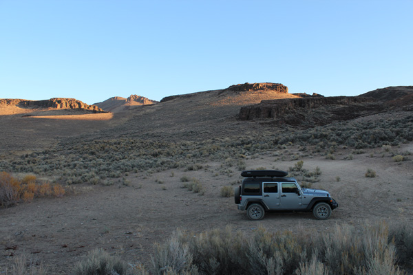
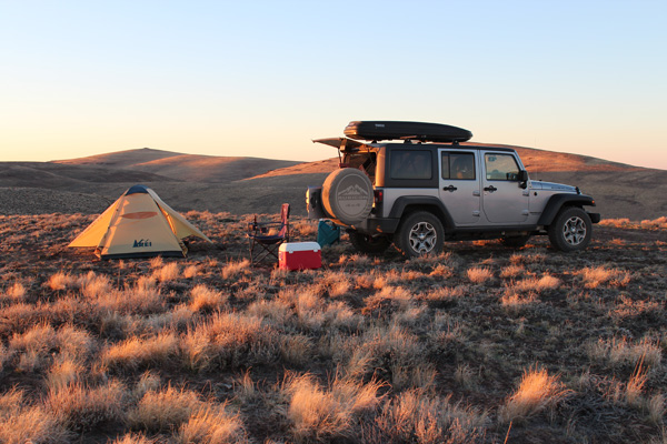
I appreciated my jeep’s good approach and departure clearances as I crossed the narrow but steep dry Cottonwood Creek bed. Only the last mile of the driving route was particularly primitive. I found a pleasant campsite at Little Pinky Reservoir (a dry pond bed this time of year) for the evening and night.
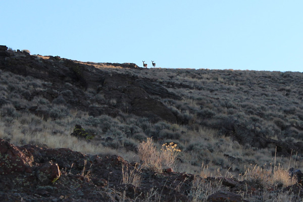
Friday morning, October 25, was clear and calm. I left my camp and hiked north to reach the “South Ridge”. As I climbed the sunrise light worked its way down the ridges and peaks near and far. As I approached the south ridge line I looked up and saw two deer watching me from above.
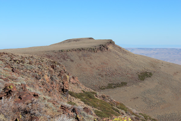
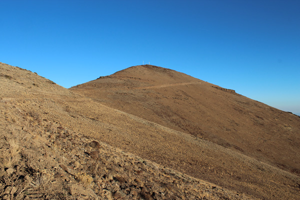
Once on the ridge, I climbed upwards to the northwest to reach a plateau. Here I saw my destination peak for the first time. I traversed further north along the plateau then followed a primitive jeep track. The jeep track paralleled an old fence line through a grove of mountain mahogany. From the grove I climbed up a steep ridge to the summit plateau. I traversed the plateau north to reach the Oregon Canyon Mountains Highpoint.
I savored my success. From the summit I studied the surrounding ridges hoping to be able to identify the highpoint from Highway 95 in the future. I found the summit register. Reading it I recognized several names from peakbagging websites. I was pleased to see the names of two friends who had been the first to climb Oregon’s 100 Highest Peaks.
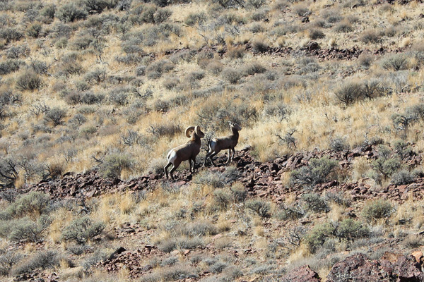
I returned the same route towards Little Pinky Reservoir, and on the way surprised a herd of desert bighorn sheep. Fortunately they did not panic. By traversing out of sight above them I was subsequently able to descend rather close to a pair of them. Viewing the bighorn so close was an unexpected bonus to a successful day.
My drive back to McDermitt was uneventful. After refilling my jeep’s gas tank and my water container I drove north towards Blue Mountain Pass. Along the way I stopped to study the view of the Oregon Canyon Mountains to the west. I thought I recognized the range highpoint.
Blue Mountain
From Blue Mountain Pass I turned west, then north up an access road for Blue Mountain. Blue Mountain is one of Oregon’s 100 Most Prominent Peaks. The access road was dusty. Some road construction equipment was parked beside it. Perhaps the road is under recent development.
As I climbed higher towards the summit of Blue Mountain I found a scenic and usable campsite on a saddle at about 6600 feet. I parked here and enjoyed sunset views and dinner from my camp.
Friday morning, October 26, I hiked the remaining 1.3 miles to the summit radio installations. Eventually I found the Blue Mountain Benchmark near a concrete platform and towers. New facilities were under construction. The road getting there seemed to be in better shape than recent reports had suggested.
The views from Blue Mountain included many ranges in Oregon and Nevada. I recognized the nearby Oregon Canyon Mountains and Steens Mountain to the west. I noted the Santa Rosa mountains in Nevada to the south.
Sheepshead Mountains Highpoint
I returned to my jeep, drove back to the highway, and continued north to my next destination, the Sheepshead Mountains.
I found the unmarked access road leading into the Sheepshead Mountains via Ryegrass Creek. The road was dry and in good shape until it climbed above Ryegrass Creek. The road forked towards the mountain highpoint near several water troughs. It climbed steeply over rocks to a ridge line.
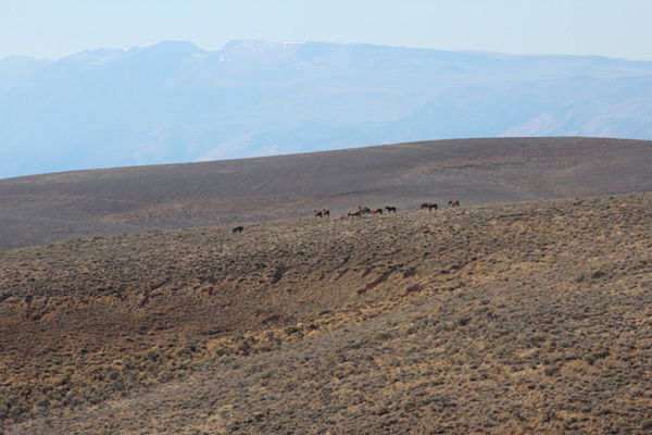
Here I first noticed a herd of apparently wild horses on a distant ridge. I followed the scenic ridge further WNW until I found a usable campsite. I parked there and watched a herd of wild horses to the SW with Steens Mountain as a backdrop. Perhaps this was the same herd I had see earlier.
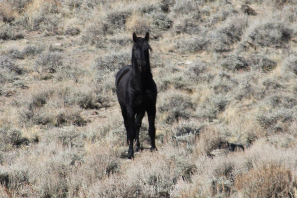
I left my jeep and followed the 4×4 road further WNW to a saddle. At the saddle I found a solo black horse watching me. The horse stomped its hoof and watched me for about a minute. Then it trotted off to the south over a ridge towards where I had earlier seen the herd of horses.
From this saddle I left the main 4×4 road and took a jeep track up to a summit ridge. I followed the ridge west to the Sheepshead Mountains Highpoint (Point 6289). This highpoint is another of Oregon’s 100 Most Prominent Peaks. It is a small outcropping of basalt with excellent views in all directions.
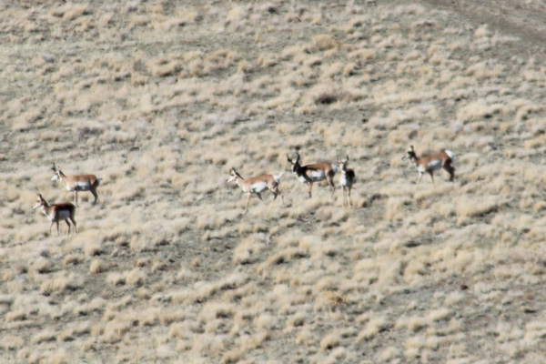
Immediately upon arriving at the highpoint I noticed many pronghorn below me. They were crossing a saddle between the highpoint and Point 6258 to my immediate WNW. Several waves of pronghorn crossed the saddle from the north and descended into a valley below me to the SW.
I watched the pronghorns for several minutes. Then I enjoyed the views of the Sheepshead Mountains around me. Further away, I recognized Steens Mountain to the SW, Blue Mountain and the Oregon Canyon Mountains to the south, and the Owyhee Canyonlands to the east.
I wanted to be sure I had visited the highpoint of the range. So I descended and hiked up Point 6258. I compared views and decided from my altimeter that Point 6289 was, indeed, the Sheepshead Mountains Highpoint.
I returned to my jeep and set up camp. I spent a relaxed late afternoon and evening enjoying the views and savoring my autumn experience in Oregon’s remote Southeast. It was a pleasant night and the next morning the sunrise added a warm glow to the views over breakfast.

Enjoyed reading. The high desert country of SE OR is fascinating. On my short list of places to explore.