Linda and I visited Marty in Lakewood in early October, camping while there at nearby Bear Creek Lake Park. The weather in Lakewood was cold and wet at first, but when a few days of dry weather arrived I spent three days hiking Colorado Fourteeners while Linda bicycled in the Lakewood area.
Quandary Peak
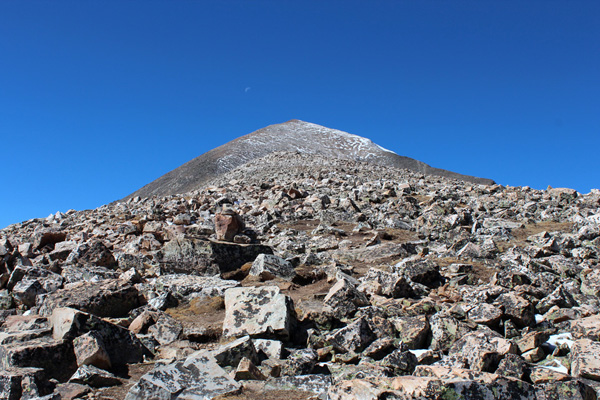
On Sunday, October 7, I drove to the McCullough Gulch Trailhead, then car camped above the Quandary Peak Trailhead. The evening was cool, but I enjoyed relaxing and preparing dinner wearing my down jacket. That night I enjoyed my winter sleeping bag and slept comfortably in the cold night.
Monday morning after breakfast I drove the short distance to the Quandary Peak Trailhead. There were several cars already parked in the small lot at 8AM. Fortunately there was ample room for me to park near the trail.
The trail started climbing in forest and crossed a few primitive roads, but the was well marked and easy to follow. Soon the trail left the forest and the rest of the route up the eastern slopes was open. It was a clear, breezy, and beautiful early autumn day and I saw a few other parties ahead of me.
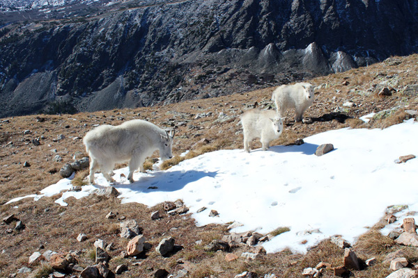
As I climbed I saw a family of mountain goats wandering about on the eastern slopes. I approached slowly and steadily and they seemed relaxed about sharing the trail with me.
The wind picked up as I climbed, but it was not excessive and the views were clear. I visited with other parties on the summit where I identified and took photos of nearby peaks. I descended the trail to find a more sheltered spot for lunch before returning to the trailhead.
The route was popular; I expect it would be very busy on a summer weekend. My timing worked well for this hike.
Mount Democrat
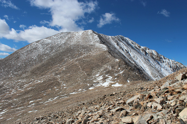
Monday afternoon I drove to Kite Lake, above Alma. The approach road is posted with a 20 mph speed limit. I was happy to oblige. Parts of the route were rocky and the road deeply rutted near the end.
Kite Lake is in an open basin below Mounts Democrat, Cameron, Lincoln, and Bross. The Kite Lake Campground consists of a large parking lot and campsites dispersed around it with a pit toilet. According to the forest service website the campground at Kite Lake was closed, but it was not gated. I paid for two day-use passes since the overnight camping passes were not available.
It was windy. I positioned my car so I could relax and cook dinner in shelter. I had the lot to myself except for one hiker who passed through early in the evening. High winds had turned him back from Mount Lincoln.
My plan for Tuesday was to hike the “Decalibron”, a single loop and extension that would take me to the summits of Mounts Democrat, Cameron, Lincoln, and Bross. However, I read on the bulletin board an announcement that Mount Bross was closed to the public. Various organizations were working with the property owner to grant access.
This presented me with a quandary – should I respect the restriction in spite of the opportunity to summit all four peaks? Or would I return another time to summit Mount Bross? I decided to defer the final decision to the next day. The wind picked up and I retreated to my car early to read and spend the night.
The wind shifted and the gusts got quite strong during the evening and night. The gusts intermittently rocked the car as I lay inside. One other car arrived after sunset and parked at the other end of the lot.
Tuesday morning I had a windy breakfast and started the Decalibron. I climbed the excellent trail to the saddle between Mount Democrat and Mount Cameron. Here I turned west and climbed the trail to the summit of Mount Democrat. Icy snow covered the ascent route in spots. But the route was obvious and somewhat sheltered from the wind until I reached the summit “plateau”. Here the wind was strong. I visited with some other hikers, identified and took photos of peaks, and descended towards the saddle to continue my quest for the other summits.
From the saddle I started climbing the west ridge of Mount Cameron. The wind was stronger as I moved up the ridge and further away from the shelter provided by Mount Democrat.
The wind was from behind me. I often turned to face it to verify I could safely descend if needed. Higher on the ridge the wind buffeted me harder. I put on warmer gloves and a balaclava, the latter to better secure my cap and to help me breathe when facing the wind. Eventually the wind gusts made walking more difficult in spite of my using hiking poles. One gust seemed to threaten to blow me off the ridge as I climbed towards Mount Cameron. The route ahead was quite exposed to the wind. I decided to turn back rather than risk getting pinned down further on should the wind increase.
My quandary about climbing Mount Bross was settled. I would return another time to hike the remaining three peaks when hopefully Mount Bross reopens to the public.
Grays Peak and Torreys Peak
After returning to my car I drove back to I-70 and then east to the Bakerville exit. From here I drove three miles to the Grays Peak Trailhead. This trailhead included a large parking area with a pit toilet. The road had a few narrow sections, but several pullouts and the traffic was light this time of year.
The parking area was well protected from the wind with dispersed campsites nearby. I relaxed and enjoyed dinner with a view of Grays Peak before settling in for the night.
After breakfast Wednesday morning I started up the Grays Peak Trail. I crossed Stewart Creek and climbed up the valley towards Grays Peak. I soon passed a hiking couple from Germany.
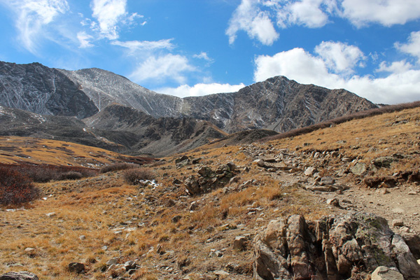
It was another windy day but not quite as windy as the day before at Kite Lake. There were clouds above the ridge to my left and stacks of lenticular clouds to the east of the Front Range. I watched the sky for developments as I hiked. After about a mile I rounded a corner and saw Torreys Peak ahead of me as well as Gray Peak. Grays Peak is to the left and Torreys Peak to the right in the photo above.
The obvious trail climbed and traversed a ridge between me and the peaks, then switchbacked up the southern face of Grays Peak. Thin and dry snow covered the trail in spots. This gave the hike an extra alpine flavor. The trail passed a junction with another trail leading down from the Grays/Torreys Saddle, and I saw a hiker descending. This was to be my descent route as well.
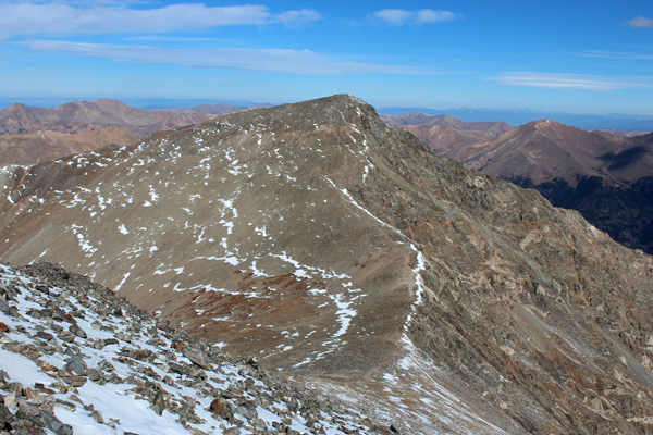
The trail continued to the windy, but tolerable and clear summit of Grays Peak. From the summit I viewed and took photos of the surrounding and distant peaks. I took a few self portraits as well. I packed up and descended the north ridge trail towards the Grays/Torreys Saddle.
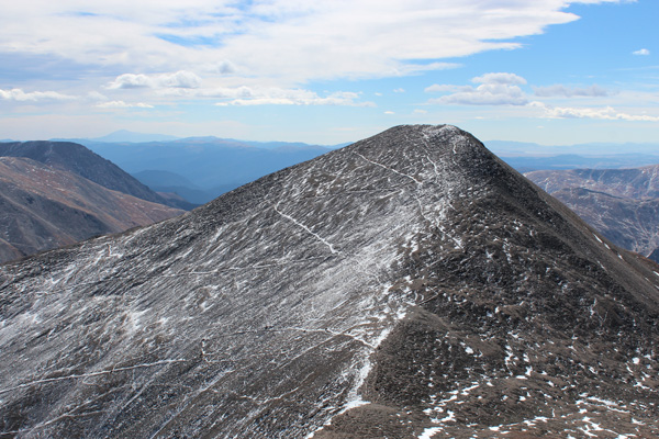
I passed the well-marked descent route and continued up the ridge towards Torreys Peak. At points the trail approached the steep drop to the east. I gave myself extra space in case the wind gusts from the west suddenly strengthened.
I soon reached the summit of Torreys Peak. Here I carefully placed and anchored my pack in a protected spot then enjoyed and photographed the views around me. The snow-dusted and trail-carved face of Grays Peak gave it an interesting texture. The steep eastern face of Torreys Peak below me enhanced the alpine views.
I descended down to the saddle, took the connecting trail leading to Grays Peak Trail, and returned to the trailhead. I did not hurry, but lingered and savored the atmosphere at many points. The trip had been a success, with many peaks remaining to be explored in the years ahead.

Leave a Reply