In September I returned to Southeast Oregon to hike several Steens Mountain summits and remote Beatys Butte. In July I had been turned back from Steens Mountain by wildfires, and from Beatys Butte by a flat tire. Since then I had purchased new tires for my car and the wildfires near Frenchglen had died down. I was hopeful my plans would succeed this time.
Steens Mountain Summit
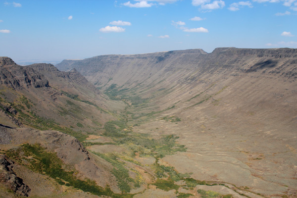
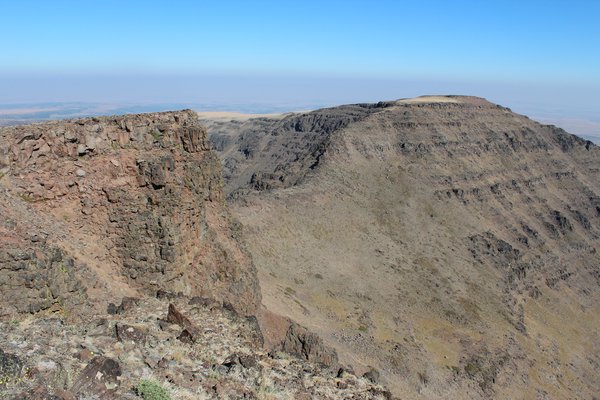
On Sunday, September 16, I drove to Frenchglen, then up the Steens Mountain Loop Road. The sky was smoky from fires in the Cascades if not from others elsewhere as well. I scouted out Page Springs, Fish Lake, and Jackman Park campgrounds for reference, then drove to the Kiger Gorge Overlook. Here I studied the summits lying on the ridge between Kiger Gorge below and Mann Lake to the east.
From there I continued to the Wildhorse Lake Trailhead. Then I hiked 1/4 mile on a gated road to the Steens Mountain summit.
The Steens Mountain summit contained several antennas, a few small buildings, and many large propane tanks. Construction of a new structure was underway as well. From the summit I looked down on the Alvord Desert far below me to the east. I had last visited the Alvord Desert in 1984; so much had happened since. To the south I viewed the Pueblo Mountains I had visited earlier that summer.
I returned to my car, then drove to the nearby East Rim Overlook. It was in July 1985 I had last stopped here for the views. The views were as impressive as before.
I finished the day by returning to the Kiger Gorge Overlook to spend the evening and night. I made dinner and relaxed by my car. The sun set and cast shadows across the gorge and up the ridge to the east. The stars come out in the clear night. Coyotes howled in the distance.
Steens Mountain – North Peak
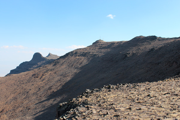
Monday morning I hiked east from the overlook across a plateau to gain the ridge forming the eastern slopes of Kiger Gorge. I descended from the plateau to the ridge down an exposed class 2 ramp. The alternatives appeared to be class 3 and I reserved them for the return.
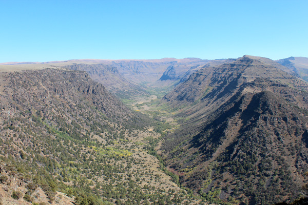
I scrambled and hiked the ridge north, staying on the ridge or to just to the east. I followed game trails or boot tracks where they led where I wanted to go. On the way north I tagged “Peak 9213” (just right of center in the above photo). Peak 9213 provided a nice view of Steens Mountain – North Peak to the north.
I continued north along the ridge about 2 miles, dropping into and climbing out of a broad saddle. I climbed onto a long plateau and hiked a mile further north to my destination. The Steens Mountain – North Peak summit was a slight rise on the far northeast side of the plateau. Nearby a U-notch terminated the plateau on its north end.
After a eating a snack and taking photos I continued north to the edge of the U-notch for a look. The notch dropped steeply to the north. Just beyond, the slope rose again to another subsidiary summit, Peak 9275. I did not have the time or ambition to tag that summit as well.
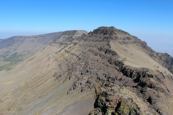
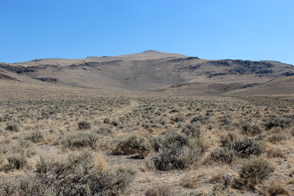
I returned the same route south along the ridge. To regain the plateau leading back to my car I selected a class 3 ascent route seen above.
My hike took longer than I had expected. But I drove the Steens Mountain Loop south since it had been so many years since I had done so. I enjoyed the drive, then continued to Denio Junction, NV, by way of Fields. Here I restocked ice and fuel, then drove west towards Beatys Butte on NV140 and OR140.
The evening was approaching. I left OR140 on a short primitive road leading to the Doherty Slide Hang Glider Launch Site. I parked here and made camp. This site is near the top of Guano Rim and overlooks Guano Valley to the west.
It was another scenic site to spend the evening and night. I made dinner and relaxed, watching the sun set behind the Warner Mountains and cast shadows across the valley below. Later I watched car headlights creep across the Valley and climb up the rim.
Beatys Butte
The next morning I returned to OR140, descended Doherty Slide, and immediately turned north on the Beatys Butte Road. After my early July experience I tried to keep my speed below 20 mph to minimize the chance of another tire puncture. I mostly succeeded in restraining myself from “speeding”. After 27.5 miles I decided to park just beyond Twin Springs and start my hike up Beatys Butte.
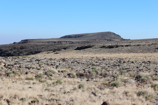
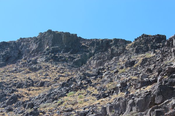
I started by following a primitive road towards the butte, but the road soon ended. I traversed left of center in the above photo to reach the shallow rocky ridge line leading towards the summit. This seemed to avoid the thicker sagebrush I would have encountered had I taken a more direct route. The upper part of the route was an open slope. The sun was warm and the air calm.
The Beatys Butte summit registry showed more visitors than I had expected. The area is very popular with hunters and the butte apparently tempts many to hike up for a view. I returned to my car by the same route. I celebrated, then carefully drove out to the paved highway and returned home.

Leave a Reply