On April 3 several friends and I attempted to climb Pinnacle Ridge in the Santa Teresa Mountains of Arizona. Pinnacle Ridge is rarely visible for those who stick to highway travel across Arizona. But Pinnacle Ridge has 2470 feet of prominence, making it the 40th most prominent peak in Arizona. We encountered much more brush than we had expected which slowed our progress considerably. With member time constraints we eventually had to turn around well short of the summit.
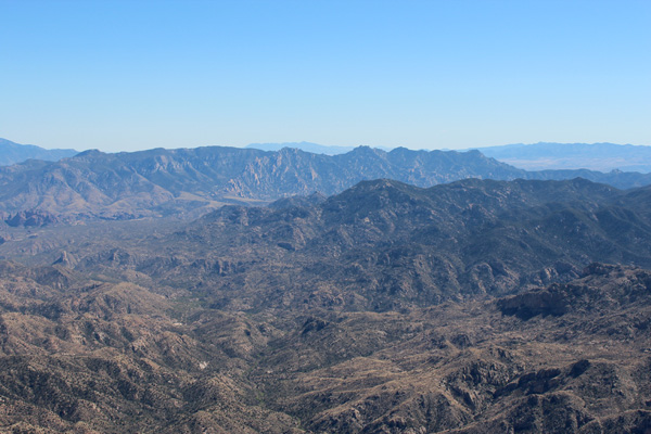
My first view of Pinnacle Ridge was on the previous day from the summit of Mount Turnbull. Pinnacle Ridge is hidden from highway views except for possibly a short section of US 70 west of Safford, AZ. From Mount Turnbull it appears to be a remote, compact, and rocky mountain range to the south.
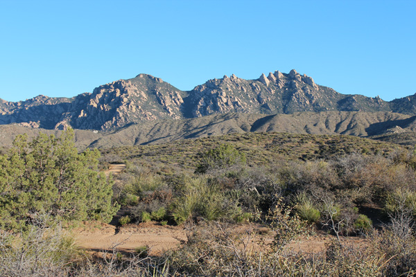
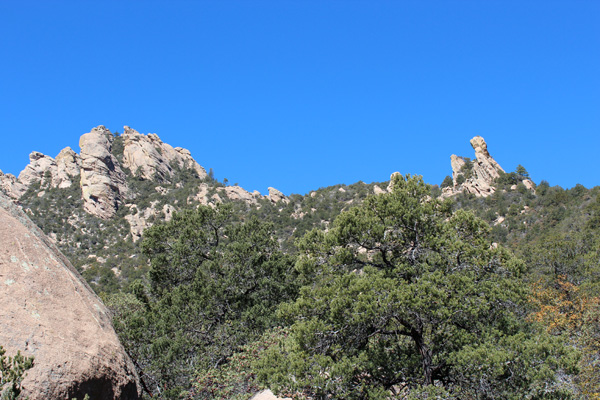
Eric Kassan, Richard Hensley, Kay Komuro, Maymay Au, and Fan joined me. We had arrived and made camp in the previous moonless dark night just south of Pinnacle Ridge. In the morning we had our first view of Pinnacle Ridge from the south. We at first thought the summit might be the rounded peak on the left in the above photo. Eventually we learned that the rock pinnacle on the right is the actual summit.

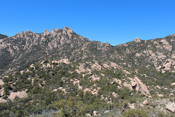
From our campsite we drove to the start of the Cottonwood Mountain Trail #66 near Sand Tank. After a short distance along this trail we turned left and followed a drainage towards Pinnacle Ridge. We climbed part way up the drainage, then traversed below Point 6440. It became clear as we approached Pinnacle Ridge that the actual summit was the rock pinnacle on the right.
We reached a forested plateau with many large boulders. From here we continued towards a saddle to the right of the summit of Pinnacle Ridge.
Our progress across the plateau was extremely slow due to poor visibility of our route, dense trees and brush, and weaved around and over rocks. We eventually stopped to review our situation on a large rock slab providing better views. We were surprised how little progress we seemed to have made in the previous hour.
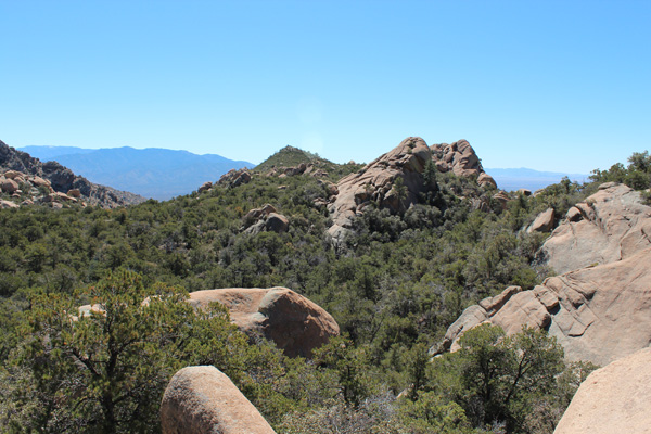
The slope ahead lead more steeply up towards the saddle on the ridge above us. It appeared quite rocky and brushy as well and would likely require a lot of time to travel.
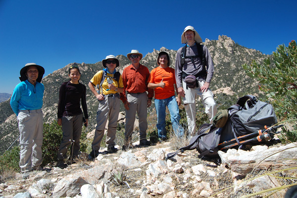
The summit itself, visible in the left in the above photo, promised to be a lengthy and steep challenge. It would likely take us much time to work out the ascent route up to the summit. We supposed this would include climbing the brushy gully splitting the pinnacle followed by some exposed face climbing. We decided to turn around and carefully descend our route.
As a consolation we climbed Point 6440 on our way out, which we unofficially named “Manzanita Peak”. Richard noticed some swarming bees below us as we prepared to descend. But we bypassed them and avoided a possible “africanized bee” attack.
We learned much about how to access Pinnacle Ridge, the likely best route to take up it, and the time and commitment required to summit. Some of us expect to return to try again.

Leave a Reply