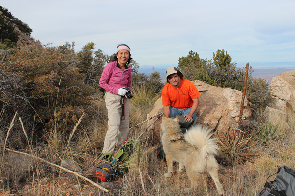
On January 23 I joined two friends, Eric Kassan, and Kay Komuro, for an attempt on Coyote Mountain west of Tucson, Arizona. Coyote Mountain is a steep and rocky mountain just east of Kitt Peak. It has a long-abandoned trail leading towards the summit. We greatly underestimated the peak and decided to turn back short of the summit. I learned a lot about Coyote Mountain and plan to try again soon.
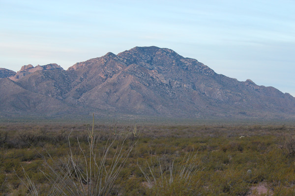
I got good morning views of Coyote Mountain from the east and north from Tucson on Arizona Hwy 86. That morning, it seemed every other vehicle I met on this highway was a Border Patrol vehicle. I wondered if that was normal for a Saturday morning.
Were to meet at parking area near the junction of AZ Hwy 86 and AZ Hwy 386 at 8:30 am. I was intentionally early and spent time viewing the west face of Coyote Mountain. We were thinking of taking a route from the west. But the slopes seemed quite steep and cliffy from my viewpoint.
Suddenly, I heard the screech of tires and saw a Border Patrol vehicle pass by on nearby AZ Hwy 86. I watched as it turned around and drove up to me. The officer asked if I was hiking. I said he was, and he warned me of the heavy drug traffic passing through the area. I assured him I was meeting others and after chatting about jeeps a bit he left me.
Soon Eric and Kay joined me. We drove a bit south to a closed gate to check out our potential route from the west. After studying the route we decided the route looked quite iffy. We would need to cross a lot of brush to enter a steep, narrow canyon with quite large rock blocks at its entry.
Instead, we decided to drive around the mountain to the east to take the standard “trail” route. Surely that would be a straightforward and reliable route to the summit.
By the time we found the correct access road and reached the trailhead it was getting late. We started up the abandoned road about 9:45 am as the morning was getting warm. After about 1.5 miles we left the abandoned road.
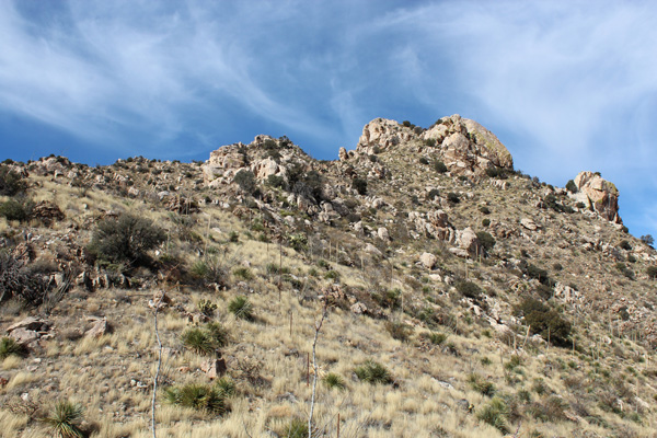
Here we tried to follow the abandoned trail leading up into a northeast-facing canyon. For the most part we were able to follow the trail up to a saddle lined with a fence. From here we climbed and traversed up the ridge to a point above us to the north.
From what I could see at the saddle the summit was far away. I hoped the trail would help us make efficient work of the route. From the point above the saddle the route continued along and near a high ridge leading west towards the summit.
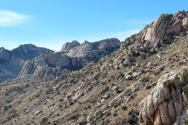
We eventually reached another saddle that appeared to be fairly close below the summit. I think the Coyote Mountain summit is the brushy ridge near the upper center of the above photo. I was tempted to continue up the ridge towards the summit. But the route appeared to have cliffs and brush higher that might slow us down. Instead, we decided to continue following the trail and hoped it went easier than what a direct route might become.
From this saddle the “trail” descended left (south) to cross the southern slopes. Then the trail climbed over ridges before climbing directly up along the left ridge line.
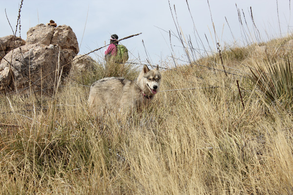
We had another companion on this hike. A husky dog apparently lives near the trailhead and likes to accompany any hikers leaving the trailhead. We discouraged him repeatedly from following us, but he would not leave us. We named him “Jo” for our friend Josef who had reported the dog to me a few days earlier as Joseph and I climbed Gu Achi Peak. Josef was concerned that the dog might have become stranded on the route when he followed Josef then.
I eventually gave Jo some of my water and food. This encouraged Jo to crawl over my pack and me whenever I stopped and removed the pack. Our dogs were very interested in the dog scent on me and my pack when I returned home.
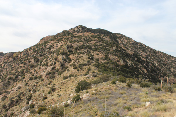
The thorny brush and cactus covering the abandoned trail was at times hard to follow even with occasional rock cairns. We spent too much time trying to follow the trail as it dropped down and climbed up steep southern slopes and over rocky ridges. Finally, at 3:30 pm and after 5.5 hours of hiking we were out of time and low on water. We had to turn around, about 1/4 mile and 300 feet vertical through brush and over rocks from the summit. We had a long descent ahead.
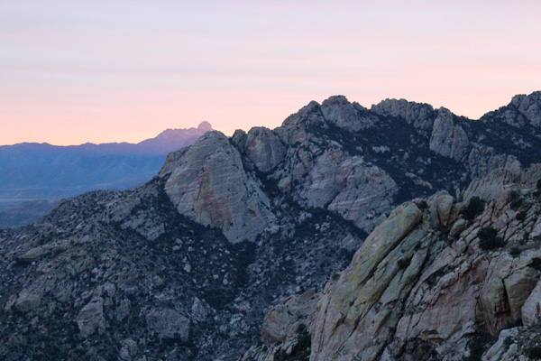
About 5:45 pm the sun was starting to set and it cast alpineglow across mountains to our south. This photo is looking across some southern slopes towards the southern ridge of Coyote Mountain. The alternative route we had considered earlier likely would have required us to negotiate the southern ridge cliffs. So we did not regret avoiding that choice.
I hoped to reach the saddle above our descent gully before dark. Otherwise, following the vague trail on the ridges would become quite difficult by headlamp.
We did not beat the darkness to the saddle. So the last two hours on the return was by headlamp in the dark. Our morning’s GPS track was helpful in finding and following the overgrown trail down the gully towards the abandoned road. For some time a Border Patrol helicopter hovered close above us and spotlighted us and the surrounding slopes.
We returned to our cars after about 11 hours of travel. We were disappointed with getting turned back from the summit. But it was a memorable day and evening and a good lesson in respecting Arizona peaks. Next time I will get an earlier start. I may also try leaving the trail to make a more direct route towards the summit rather than follow the trail across the steep southern slopes and ridges through brush and cactus.

Leave a Reply