For the past two winters we have traveled to Arizona to spend a few weeks bicycling and hiking in the sunshine. Early this year we spent about 8 weeks in Tucson, our new winter home. While settling in we bicycled many routes around the Tucson area. I also enjoyed several peak hikes in the surrounding mountain ranges.
Wasson Peak
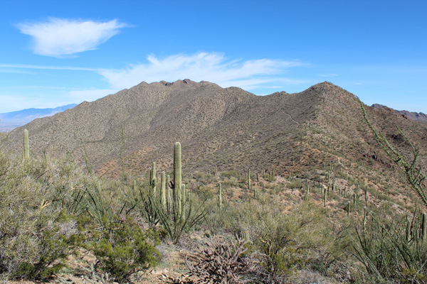
On Thursday, February 19, I hiked Wasson Peak in Saguaro National Park West (Tucson Mountain District) via the Hugh Norris Trail. The summit of Wasson Peak is the highest point in the Tucson Mountains with 2117 feet of prominence. It was a warm and sunny day. The hike was a good shakedown after months of relative inactivity.
I enjoyed watching several USAF jets pass over. It reminded me of my early years living on USAF bases and of my deceased father.
Hutch’s Pool
By the end of the Wasson Peak hike my toes were sore. My feet seem to have gotten larger as the years pass by. So I purchased larger boots and hoped they would work better.
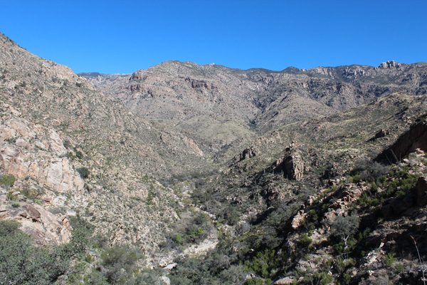
To test the boots before trying another peak I hiked to Hutch’s Pool in the West Fork Sabino Canyon, part of the Pusch Ridge Wilderness. I enjoyed the clear skies and ideal temperatures and found the pool full. My toes felt much better after the hike than after the previous hike, so I felt ready to try another peak.
Rincon Peak
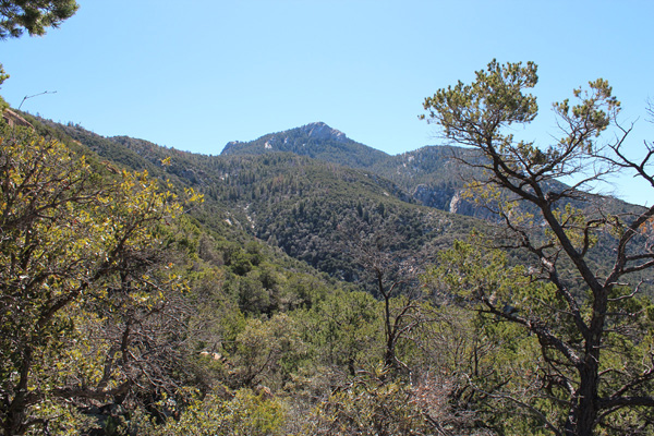
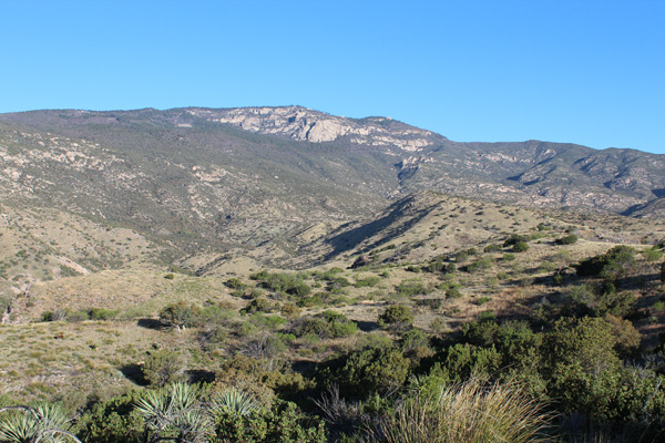
On Thursday, February 26, I hiked Rincon Peak in Saguaro National Park East (Rincon Mountain District) from the Miller Creek Trailhead. Rincon Peak is the second-highest peak in the Rincon Range and has 2282 feet of prominence.
There had been recent rains. On the drive to the trailhead I drove through several creeks across the forest road. The weather was clear and warm at the trailhead.
The Miller Creek Trail was steep, rocky, heavy eroded, and marked by cairns in ambiguous portions. Higher, most of the route was through oak and pine forest on much easier trails. The last half mile or so of the route was steep. Here there was some thin covering of snow on the ground and trail in the forest shade.
I arrived at the summit later than I had expected. I rested, had lunch, and took many photographs of the mountain scenes. It was breezy and cool on the summit
I descended the same route hoping to make up some time. But I arrived back to my jeep in the dark. I was glad to have descended the steep and rocky portion of the Miller Creek Trail before darkness. I spent the last 20 minutes descending to the jeep by headlamp.
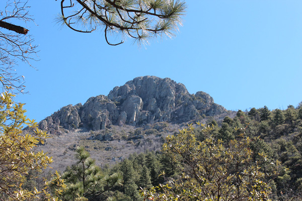
This seemed to be a quite strenuous hike – about 16.2 miles and 4300 feet of gain. I saw no other person on any of the trails that day, but watched several ravens circling about the summit rock cliffs.
Mount Wrightson
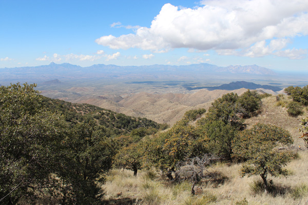
On Tuesday, March 10, I enjoyed a pleasant hike to the summit of Mount Wrightson, the highest point in the Santa Rita Mountains south of Tucson. Mount Wrightson has 4578 feet of prominence, one of the 100 most prominent peaks in the 48 contiguous states.
I took the Super Trail up and the Old Baldy Trail down, which provided me 360 degree views from the mountain of the surrounding valleys and mountain ranges. I enjoyed watching ravens circling about the summit cliffs and passing over the summit.
The hike up from Madera Canyon to Josephine Saddle on the Super Trail led through oak forest. It was one of the most pleasant hiking experiences I have had in Arizona. I met several other hikers on the Old Baldy Trail and summit portions of the hike, but only one pair of hikers on the Super Tail portions. I expect to repeat this hike in the future.
Keystone Peak
The Sierrita Mountains are a small range southwest of Tucson. I had first noticed the range from the summit of Mount Wrightson. Keystone Peak is the highest point of these mountains and has 2448 feet of prominence. It is accessible via a gated 4WD road from McGees Settlement.
On Friday, March 20, I drove to the gate at the first water tank in McGees Settlement. The gate was open and unlocked, but access was posted for authorized vehicles only so I parked my jeep there. I crossed through the open gate and enjoyed a pleasant road hike in ideal weather to the summit of Keystone Peak.
The summit had many large communication towers and many ravens gliding around the towers apparently playing tag with each other. I had good views of the Baboquivari Mountains, Kitt Peak, and the Coyote Mountains from there.
From Keystone Peak it appeared that the peak immediately to its north, unofficially named “Keystone Peak North”, might be higher. So I took advantage of a side road to visit that summit next and determined it was about 20 feet lower. I also hiked up the NW ridge of Placer Peak a short distance off the road. Here I spooked two white-tailed deer near the summit.
I enjoyed the hike back to McGees Settlement with an occasional F-16 escort above me. The gate was closed and locked when I arrived back to my jeep.
Mount Kimball
On Wednesday, March 25, I hiked Mount Kimball in the Santa Catalina Mountains. Mount Kimball has 1138 feet of prominence and lies to the west of Mount Lemmon on the Santa Catalina Crest.
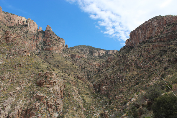
I chose the Finger Rock Canyon Trail due to its directness to Mount Kimball and the scenery it offered. It delivered on both accounts, but was steep, rocky, and slow going with many high steps and rocks on the trail. I found many varieties of flowers and steep rock cliffs to photograph.
Shortly after meeting a descending hiker who was returning from the summit I reached the junction with the Pima Canyon Trail. I followed the Pima Canyon Trail about 0.5 mile to a short access trail leading to the Mount Kimball summit.
I enjoyed the views and playful ravens around me on the summit and wished I could linger longer. But I had a long, rocky, and careful descent to make and left after only half an hour on top.
Mica Mountain
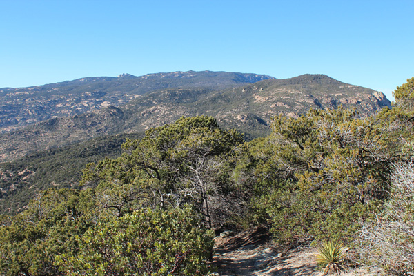
On Wednesday, April 1, I returned to the Rincon Mountains in Saguaro National Park East (Rincon Mountain District) to hike Mica Mountain. Mica Mountain is the highest point in the Rincon Range and has 4608 feet of prominence. Mica Mountain, like Mount Wrightson, is one of the 100 most prominent peaks in the 48 contiguous states. Like Rincon Peak it requires a long day of hiking to summit and return from the nearest trailhead.
The previous evening I drove to the Turkey Creek Trailhead at the end of an interesting jeep trail and camped so as to allow an early start the next morning. The next morning I hiked the Turkey Creek Trail. At the top of the Turkey Creek Trail I negotiated several trails (Deer Head Spring, Switchback, Heartbreak Ridge, Fire Loop S, Bonita, and Fire Loop N) to reach the summit of Mica Mountain amongst Ponderosa pine.
On the descent I made a side trip down the Mica Mountain Trail to Manning Camp to see Manning Cabin, then reconnected up with my ascent route. It was a long day of hiking but the weather was mostly clear with a brisk breeze and pleasant temperatures. It was a satisfying finish for my Arizona hiking this season.

[…] Read about his hiking adventures here: http://www.glassmountains.us […]